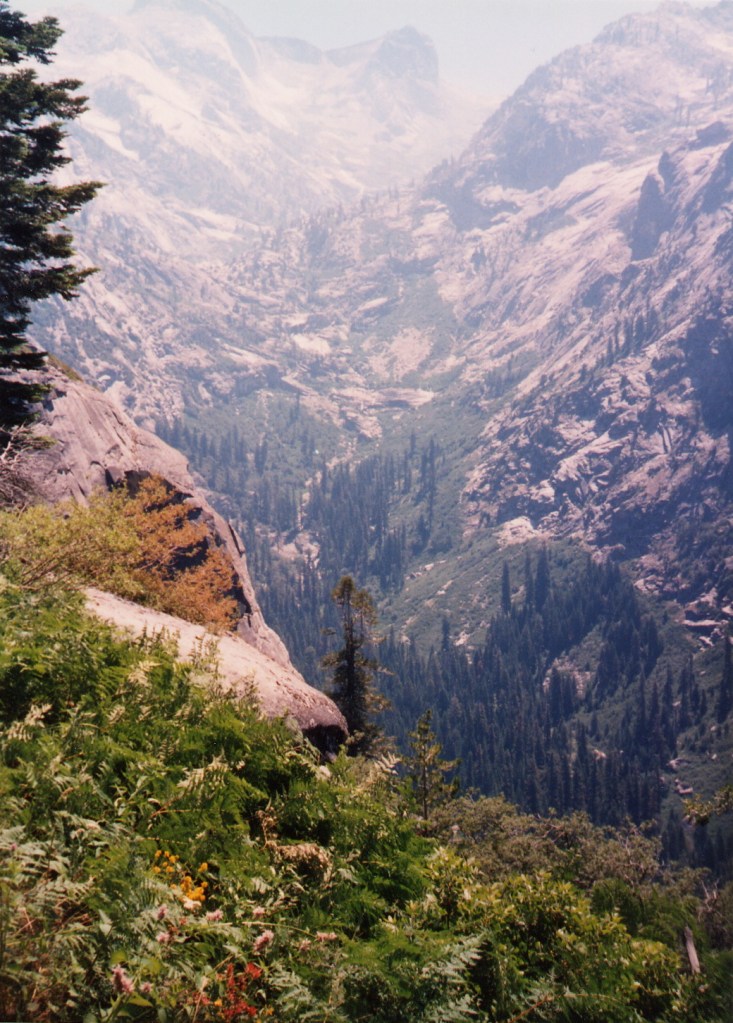
Mt. Adams with Liam

August 7-9, 2009

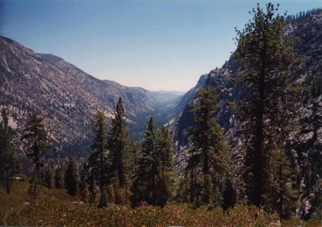
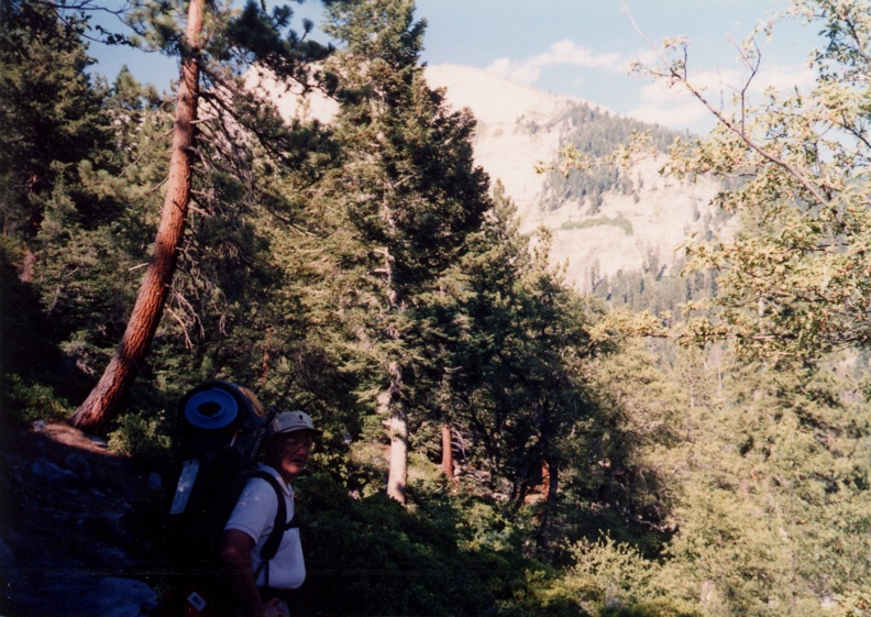
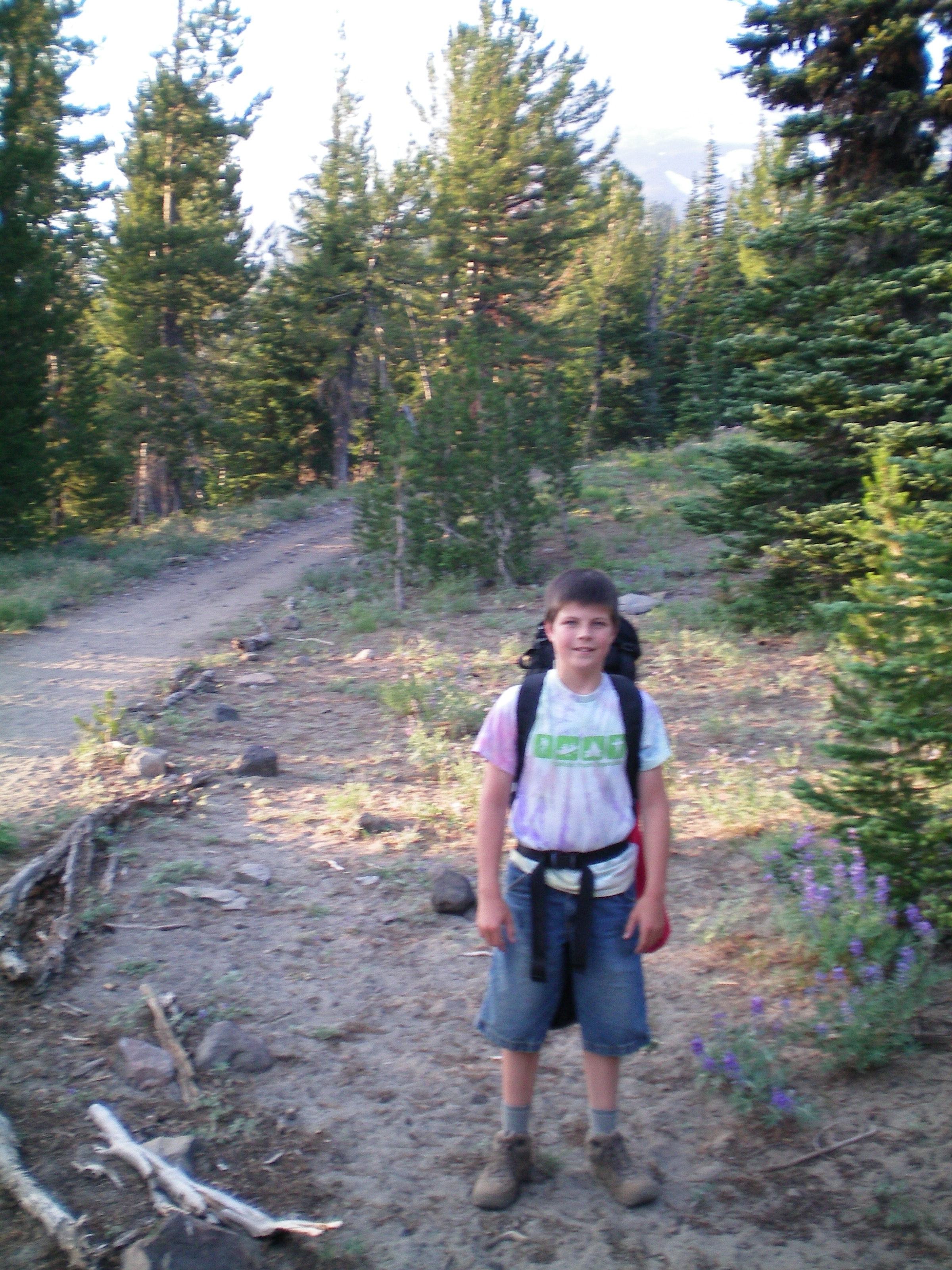
Shortly after his 11th birthday, I took my son Liam on a two-day, 90 mile bike trip between Duvall and Cle Elum, over Snoqualmie Pass and through the 2.3-mile Snoqualmie Tunnel. The next summer, when I was 47 (!), we climbed Mt. Adams together. Both trips required significant training … last year we did a lot of bike riding around town plus a few longer trips, such as from our home in North Seattle to the Red Hook Brewery in Woodinville, with the rest of our family joining us at Log Boom park in Kenmore. This year we did training hikes of Mt. Constitution on Orcas Island (my 9-year-old son Jay joined us), Mt. Si, Summerland on Mt. Rainier, and Rampart Lakes.

The training hikes were at least as much for my benefit as Liam’s — my legs were killing me after the Mt. Si hike. I was OK on the uphill, but the downhill laid a hurt that kept me from biking to work for several days.

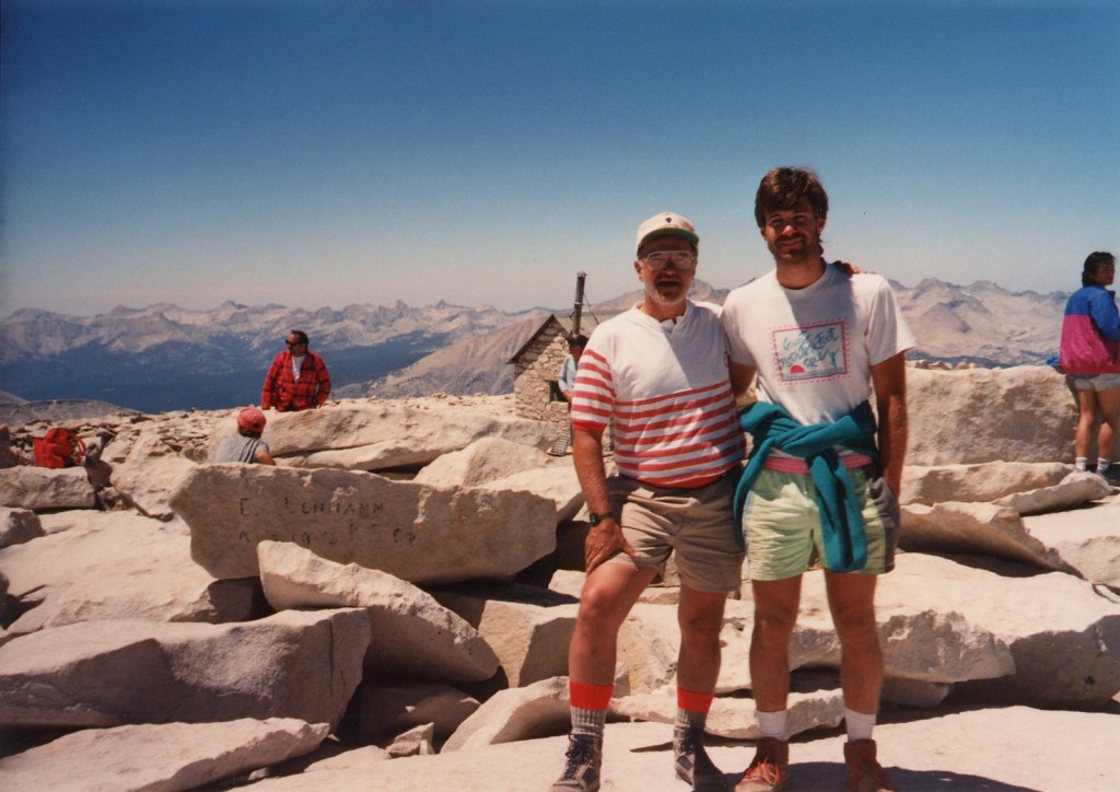
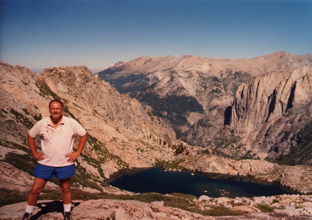
I’d climbed Mt. Adams twice before, to its summit when I was 30, and to Piker’s Peak three years ago.

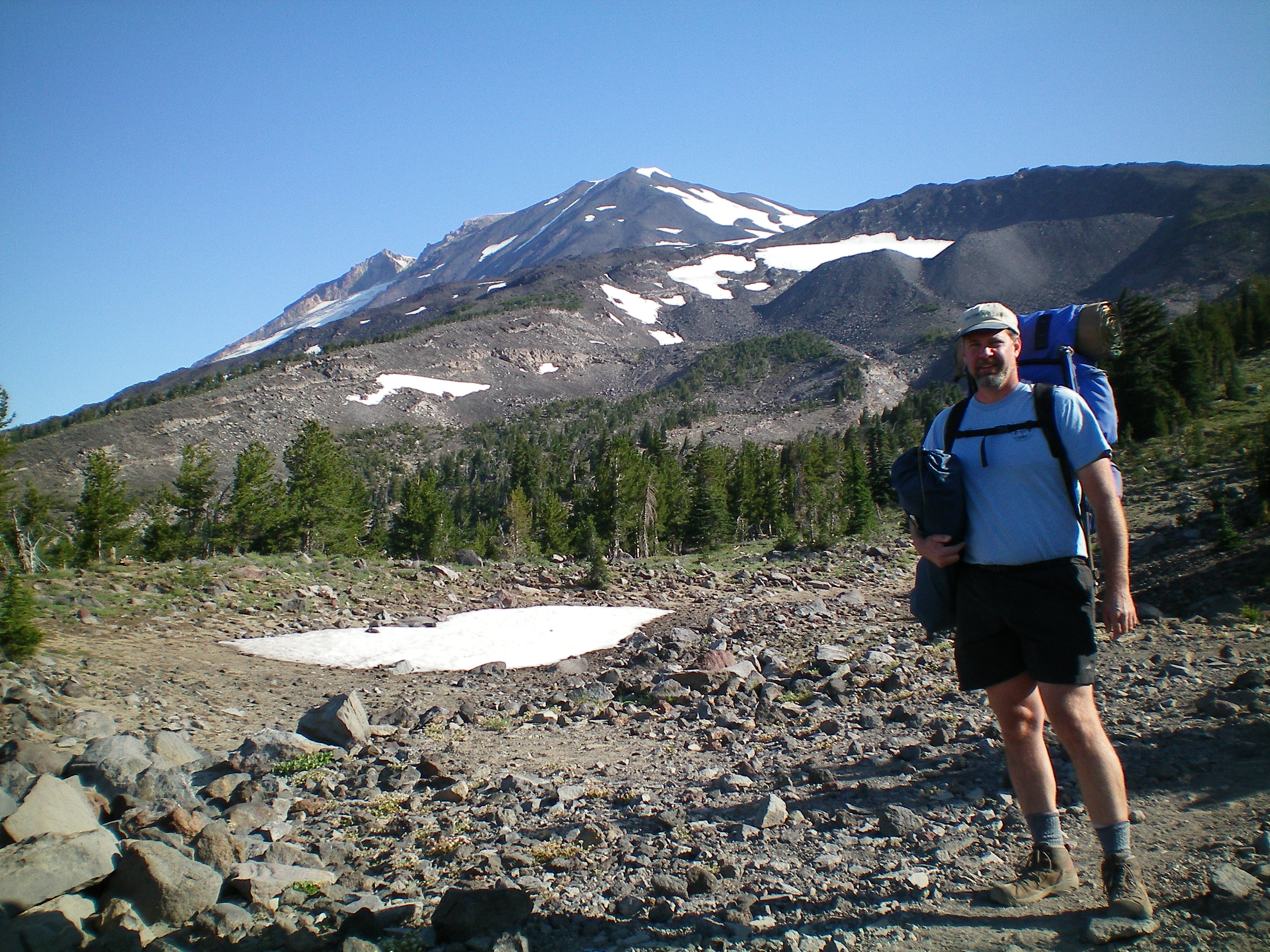
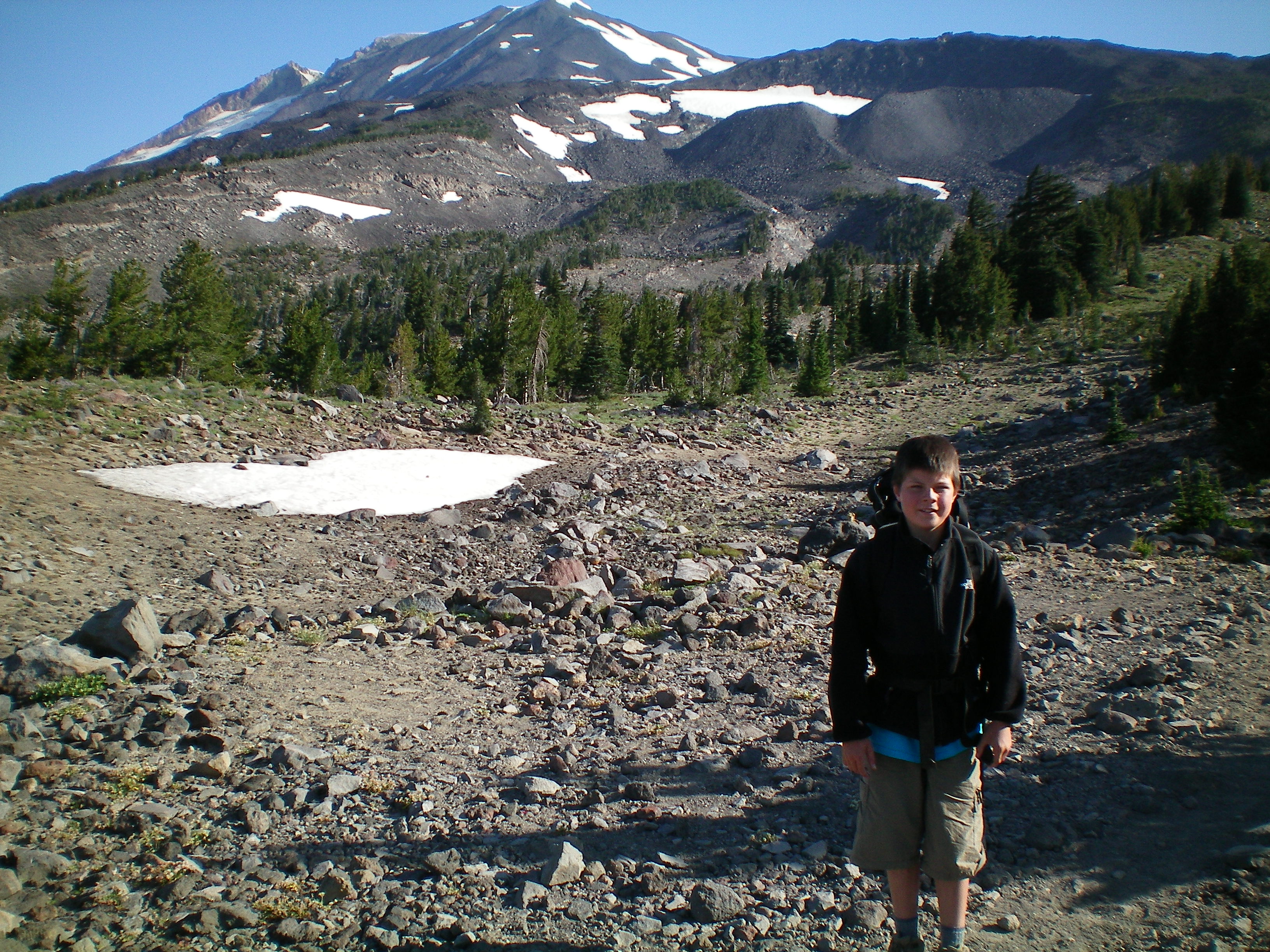
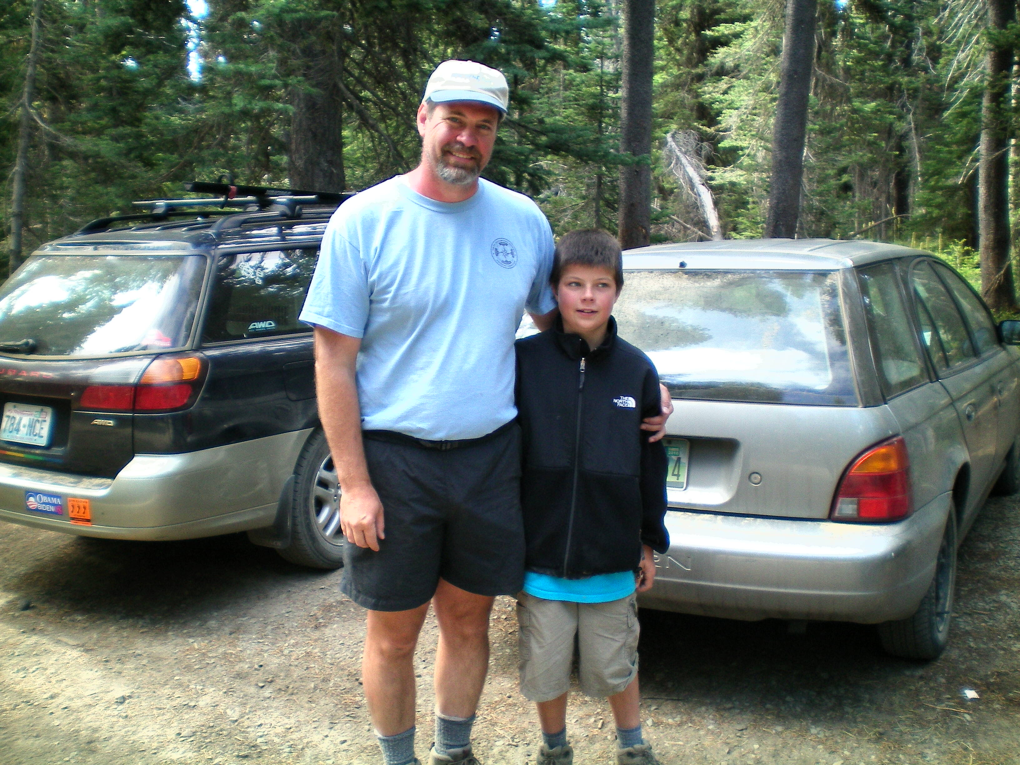
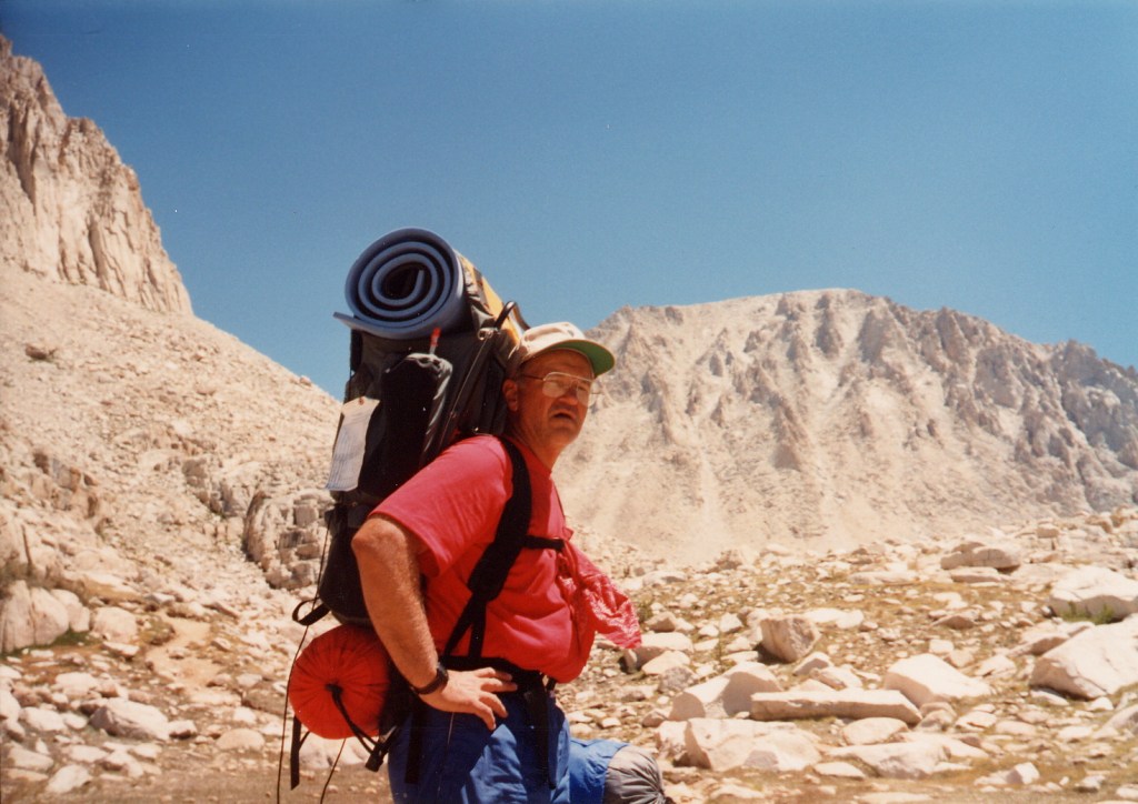
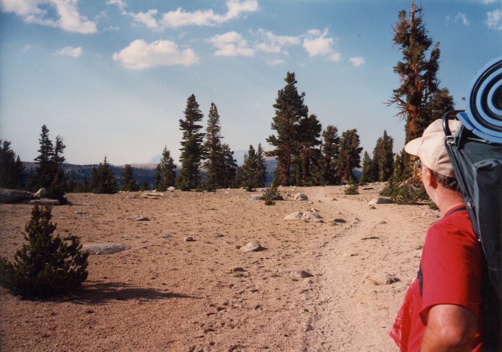
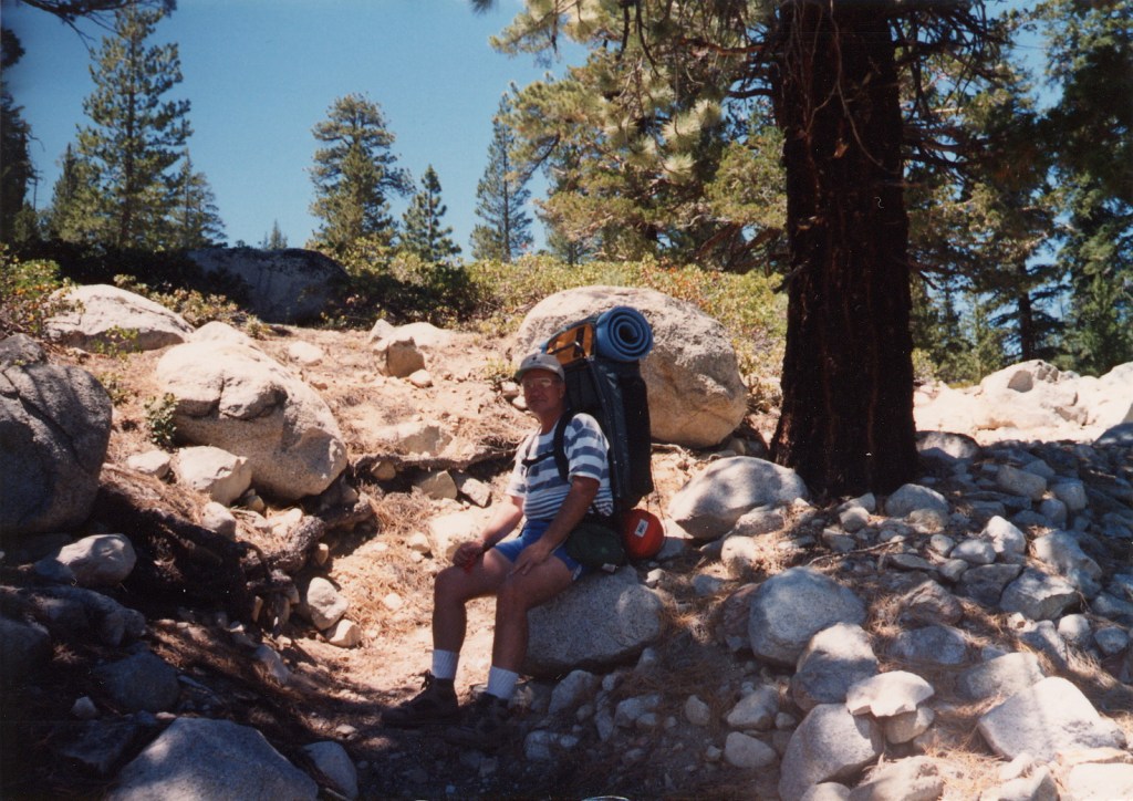
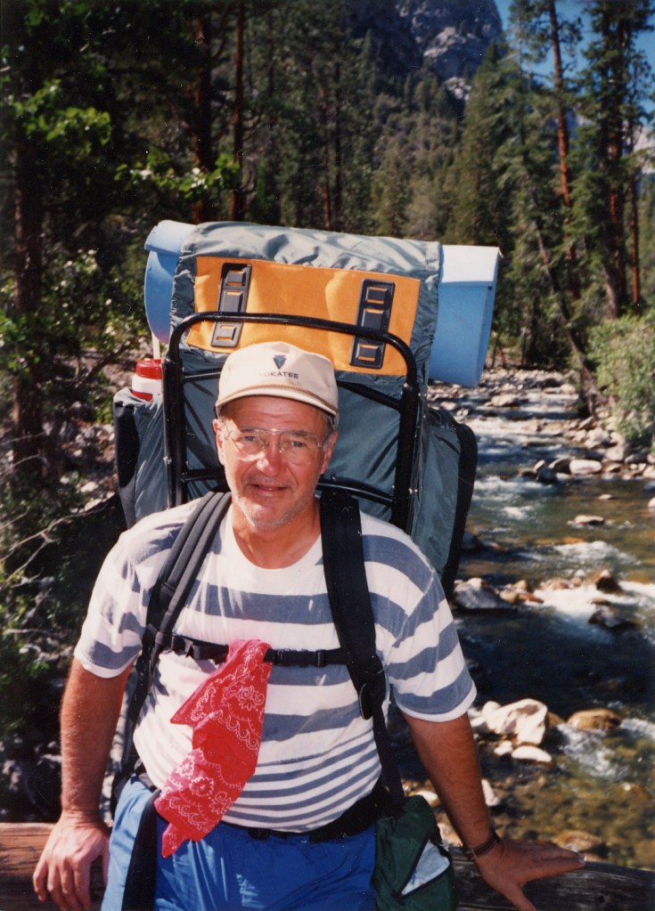
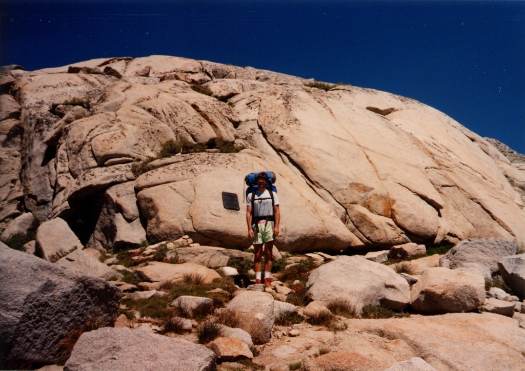
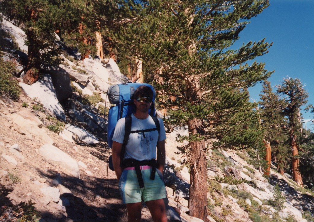
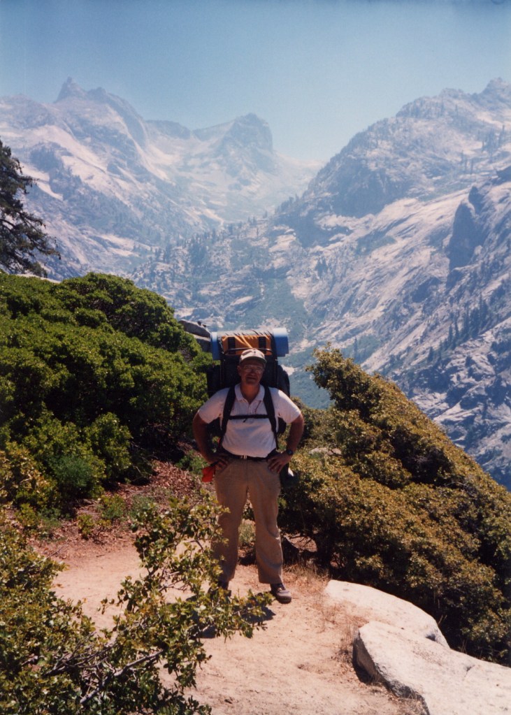
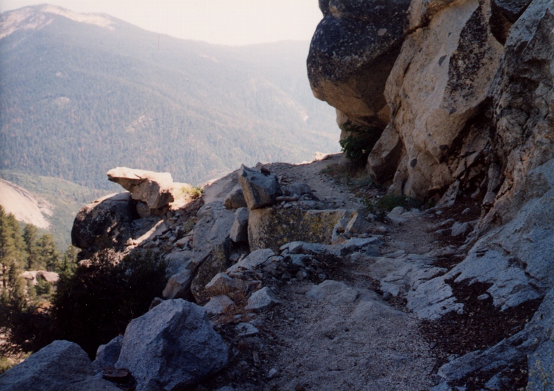
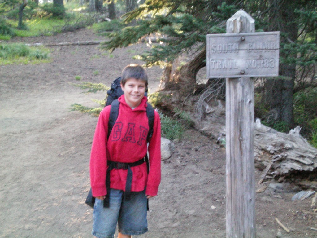
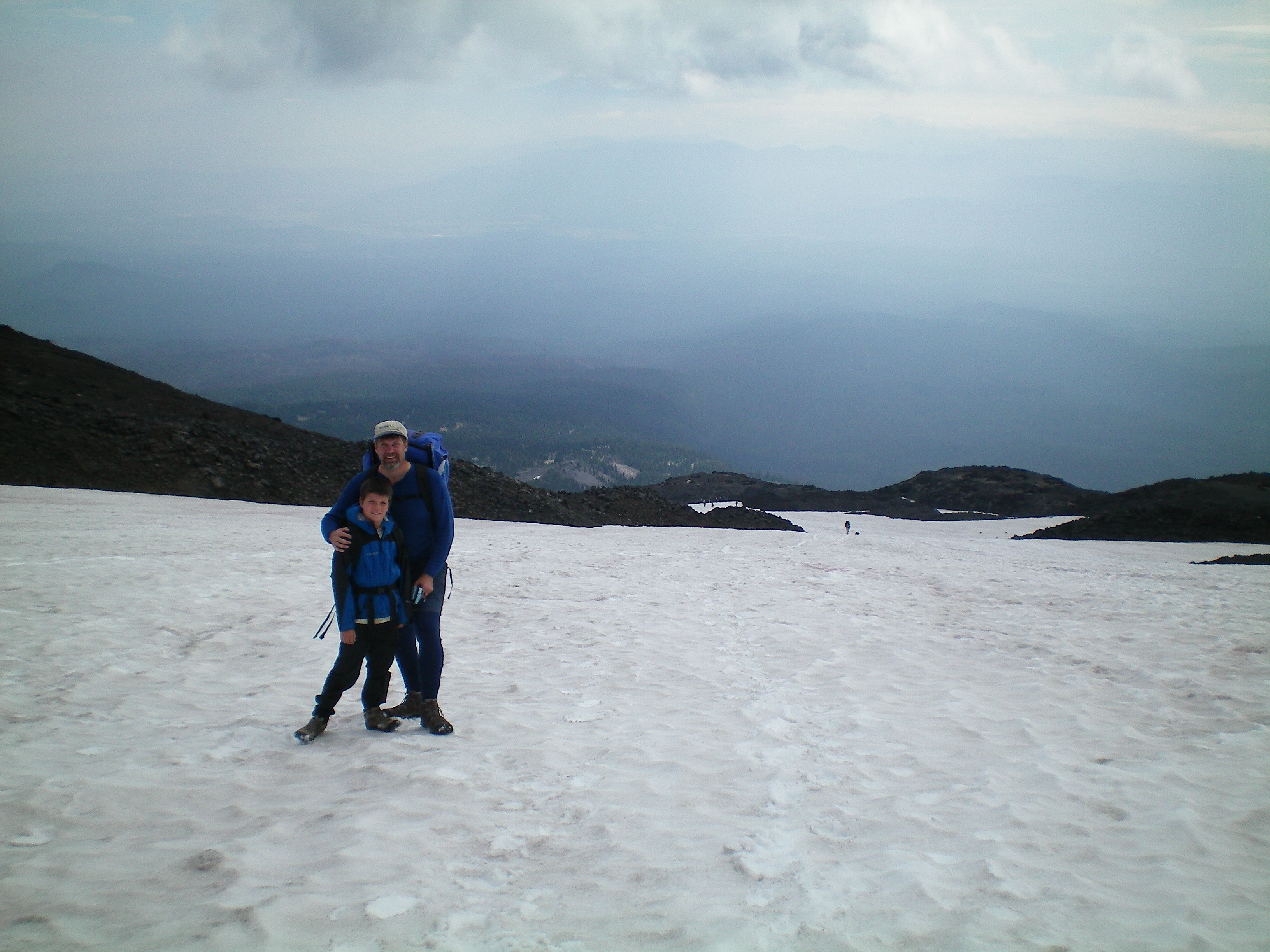
Liam took a bus from downtown Seattle to Tukwila, where I picked him up shortly after noon on a Friday, then we drove to Portland, east to Hood River, and north to the Trout Lake ranger station where we procured our Volcano Pass. We stopped along the way in Centralia for lunch at Burgerville, a restaurant chain Liam remembered fondly from previous trips through Oregon. We arrived at the trailhead at 6:30 PM, and were on the trail 20 minutes later.

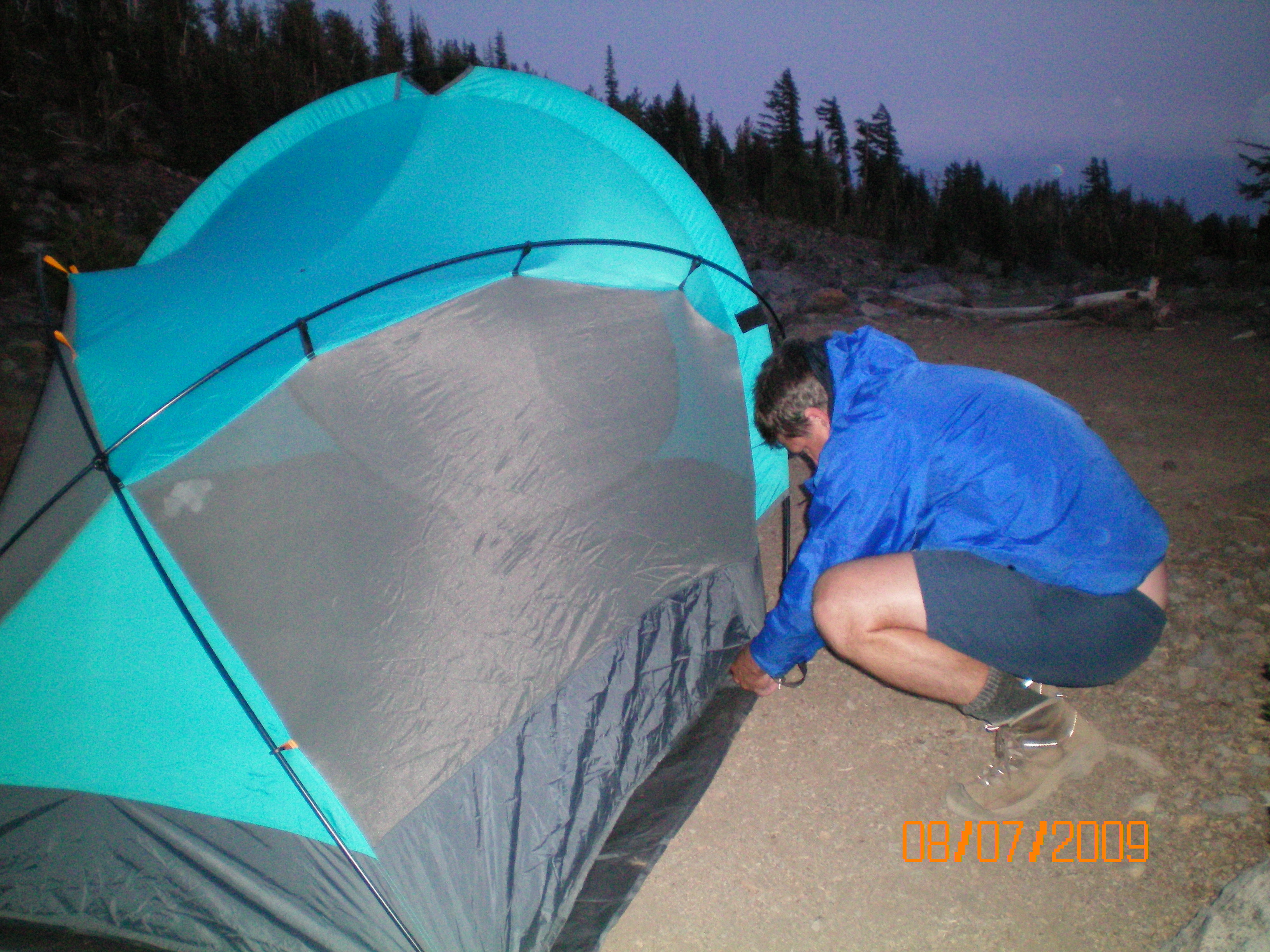
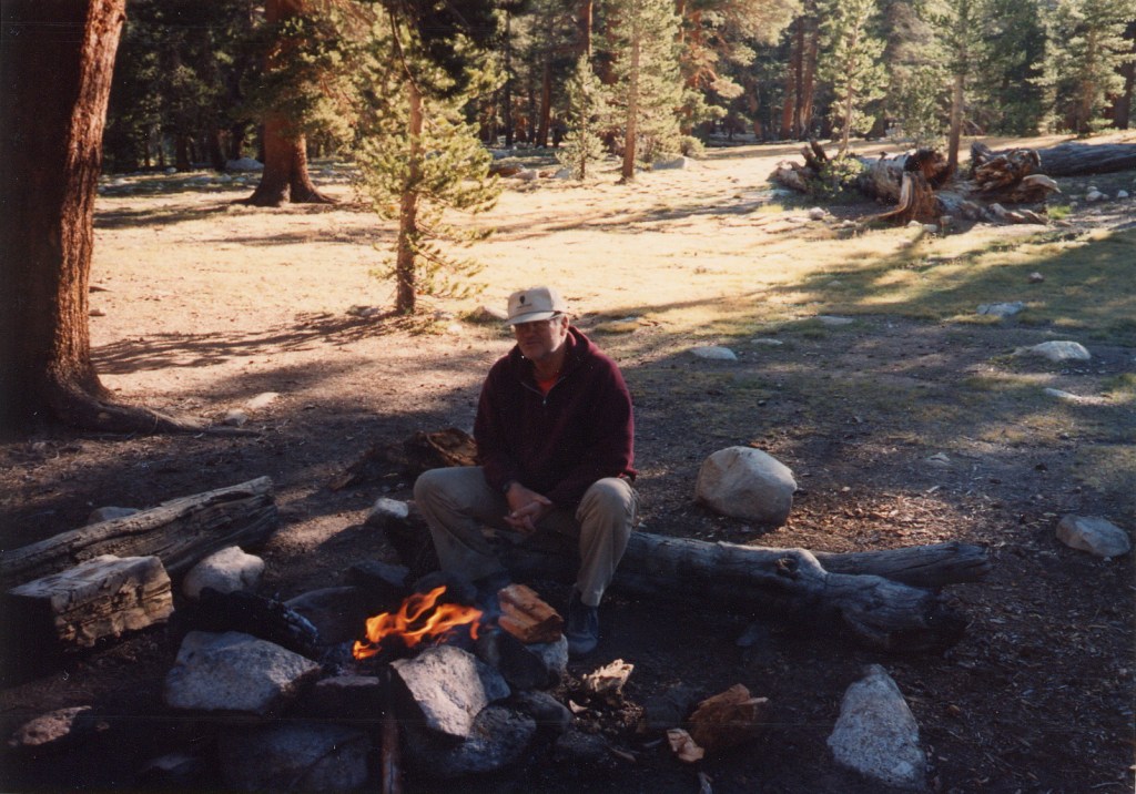
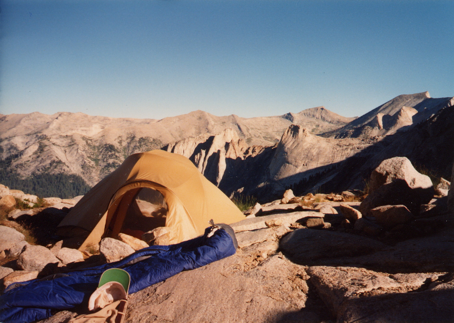
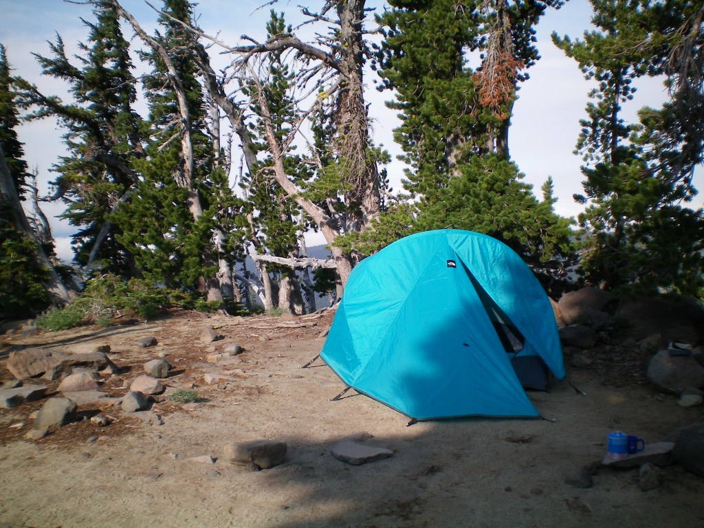
Unfortunately, this only left us about 90 minutes before sunset and I didn’t want to set up our tent in the dark, so we climbed about 1000 feet in the trail’s first three miles to the Morrison Creek headwaters and set up our tent in a campsite just a few feet from the trail. I didn’t count on more hikers coming up after us, as it was 8:15 PM and the sun was nearly down. It was a beautiful spot.

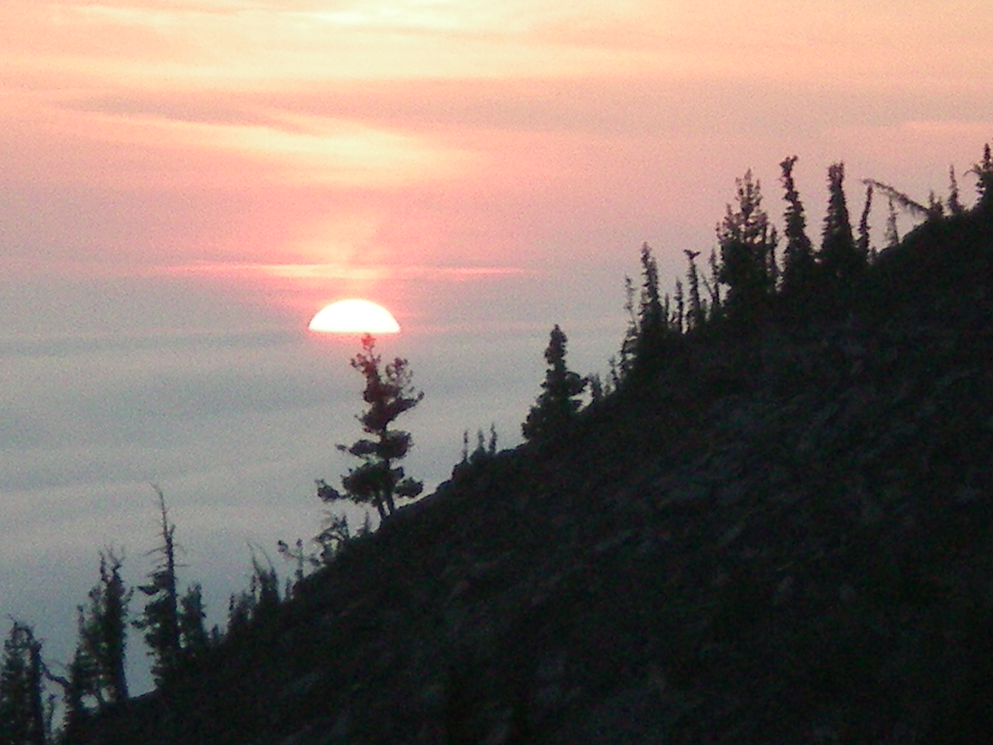
True to form, a pair of women came up while we were setting up our tent. We boiled water for dinner, which was a pouch of Lipton Noodles and Sauce. Like almost everything I’ve ever prepared in the wild, it was good, but to Liam it was astonishing: “This is great!” he said. I told him everything tastes better in the wild. After dinner we lay down side by side on a campsite in a nearby meadow and watched the stars come out. We were at 6500′ and I’d been hoping we would get a sky full of stars to the horizon, the Milky Way, and some shooting stars. Well, we saw more stars than we do in the flatlands, but the sky near the horizon was hazy, and even looking straight up it wasn’t clear enough to see the Milky Way, though we did see a few shooting stars and one satellite.

When I was younger I remember lying in a similar position, even at a lower altitude in a Los Angeles suburb, and being absolutely conscious of the inexorable wheeling of the stars. This night wasn’t clear enough for that, but it was still nice to lie next to my son and point out many of the northern constellations, seeing many more stars than we normally do.

We finally went into the tent at 11:00 PM. I woke at 1:00 AM when a group of hikers went by, and again at 4:00 AM when two more groups walked past, then again at 5:00 AM, their boots crunching in the trail’s rocky sand, their headlamps briefly lighting up the inside of our tent like daylight. OK, lesson learned: don’t camp so close to the trail; climbers hike at all hours.

After moving the tent

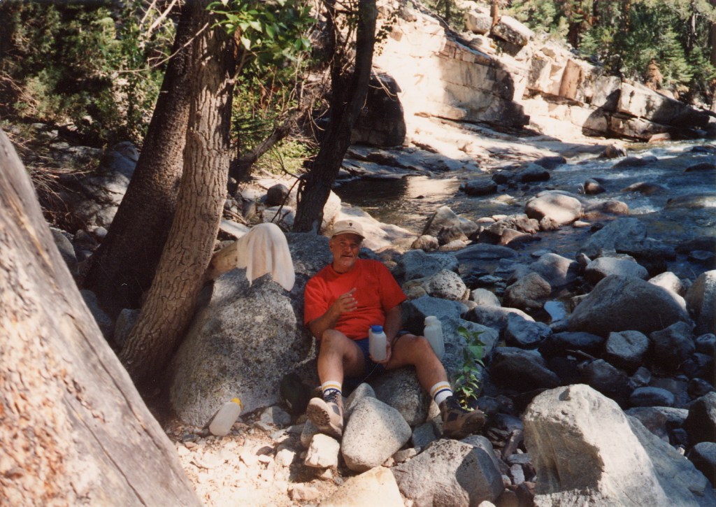
Next morning, I dragged myself to the creek to boil water for instant oatmeal. The only flavor we had enough of for both of us was the “original” flavor, ie unflavored, which for instant oatmeal amounts to the flavor of shredded paper. I walked back to the tent to let Liam know that breakfast would be ready in five minutes. To my surprise, he got up, dressed, and walked down to the creek in less time than that. And no, not even the added flavor bonus of the wilderness was enough to make that “original flavor” instant oatmeal palatable. I separated the dried cranberries from a bag of gorp and added them to the oatmeal to see if that would help, and it did indeed, but it still wasn’t what one might call delicious. We were down to three liters of water so I boiled up two more from the creek. I also moved the tent much farther from the trail.

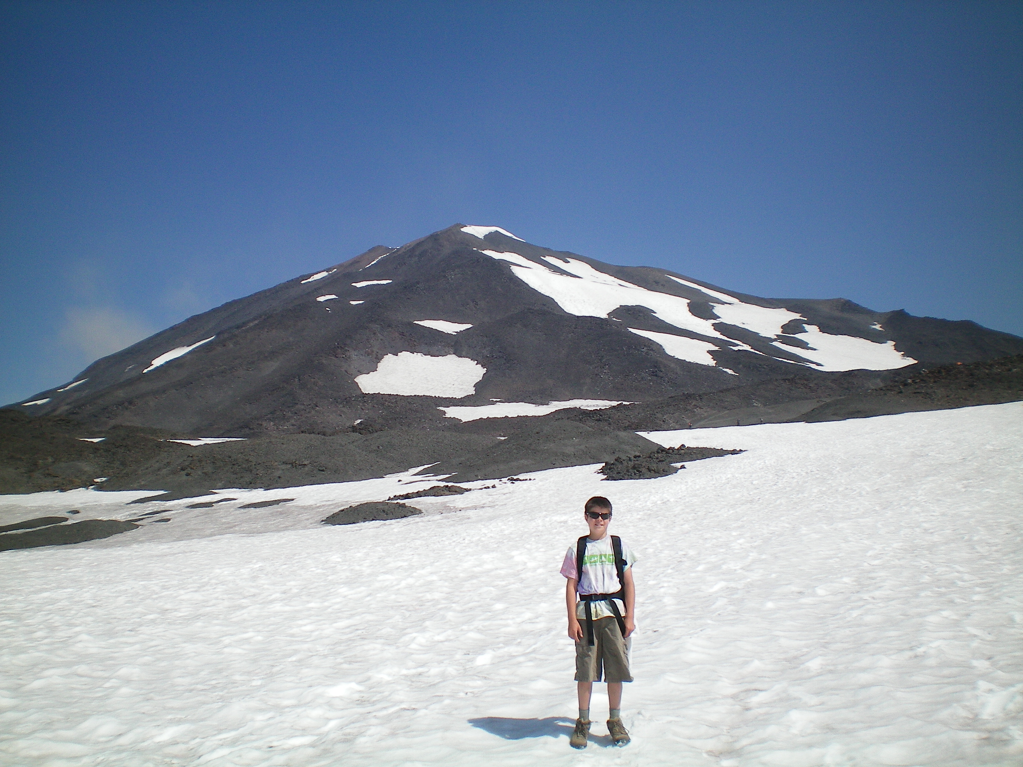
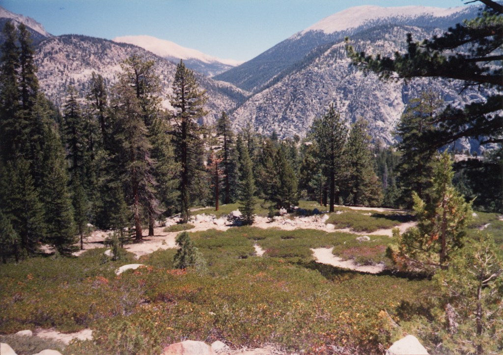
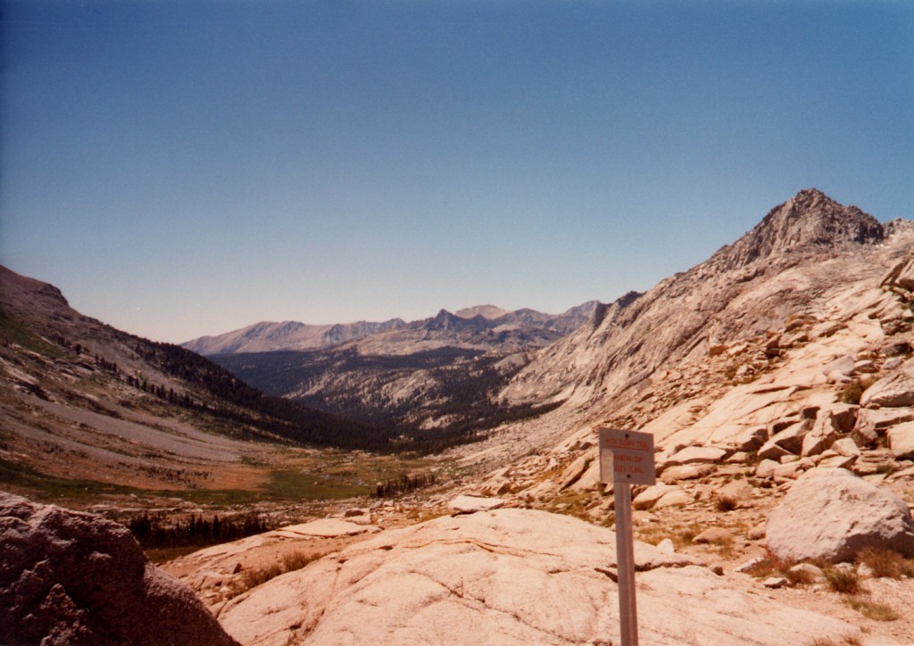
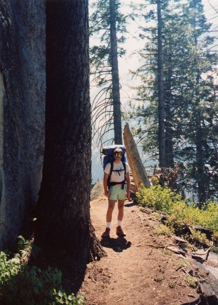
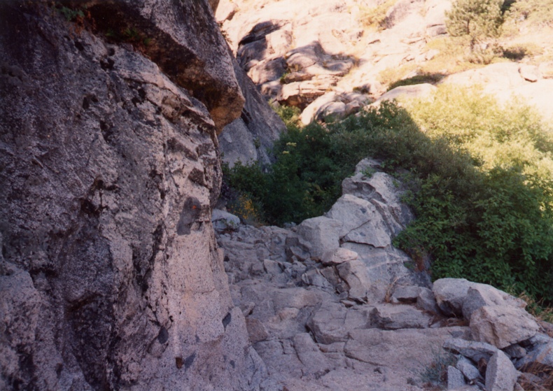
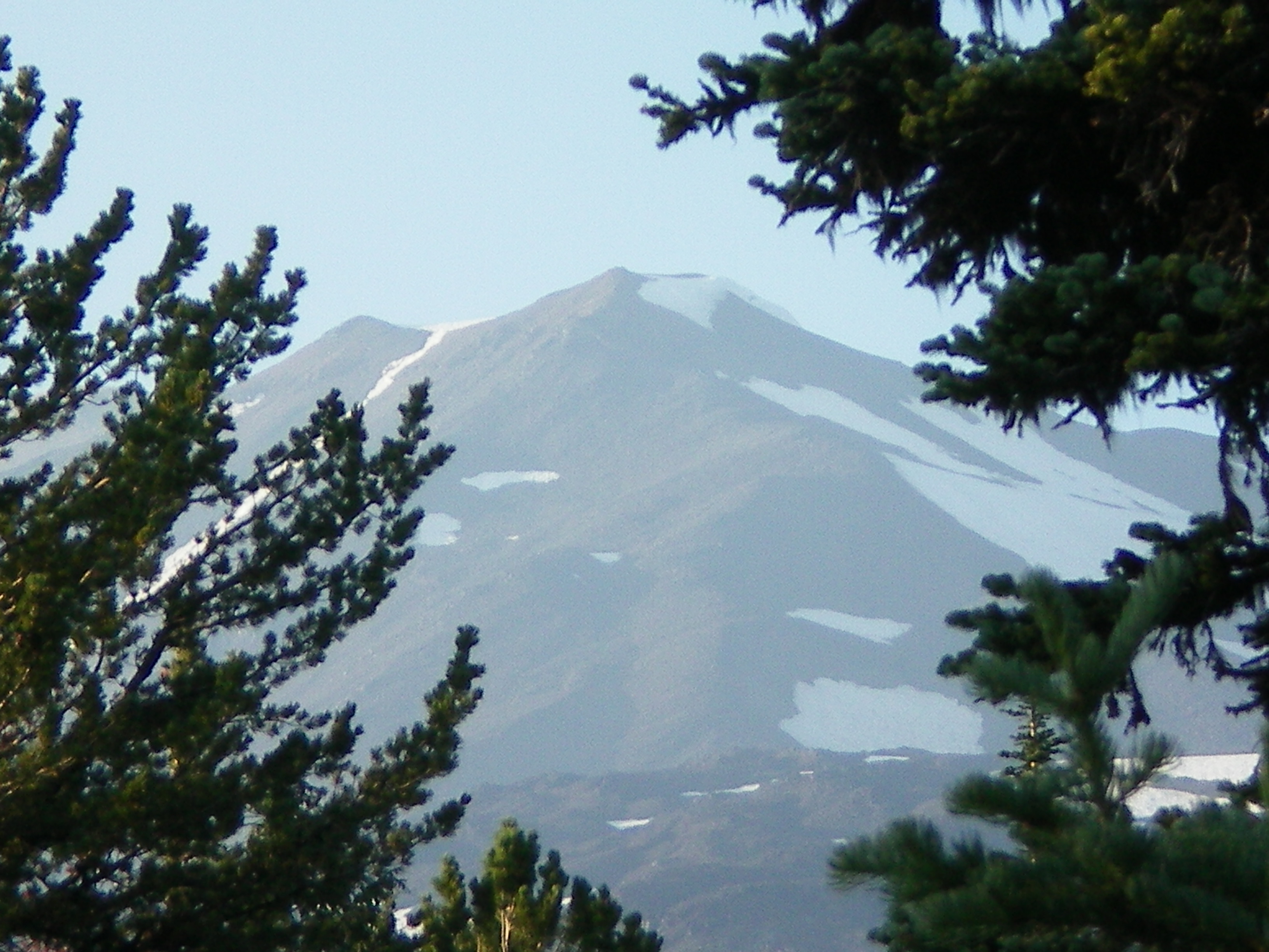
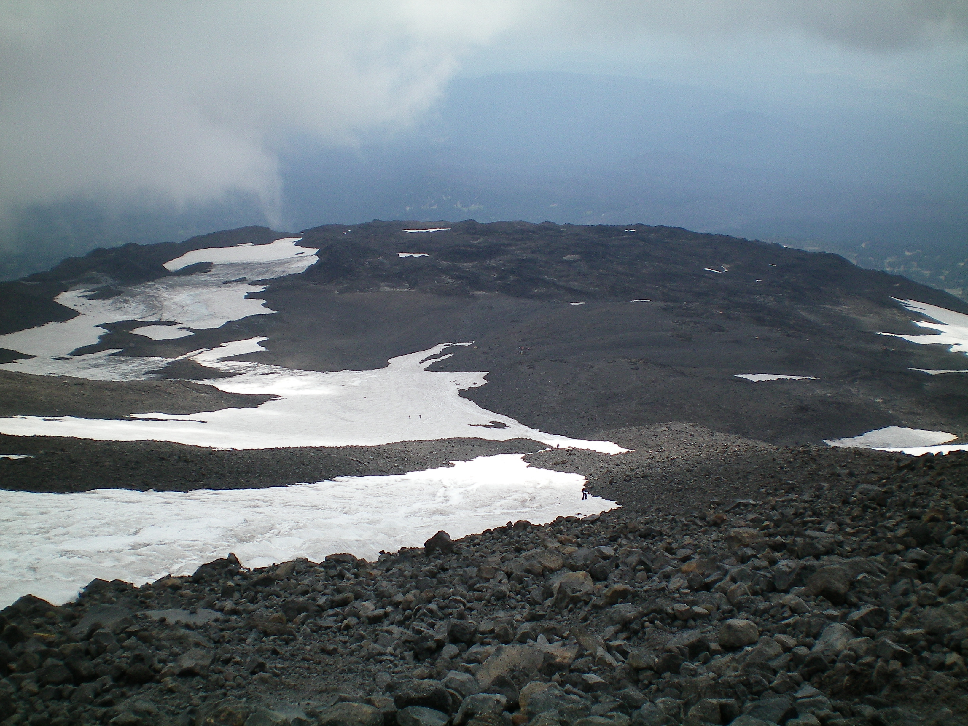
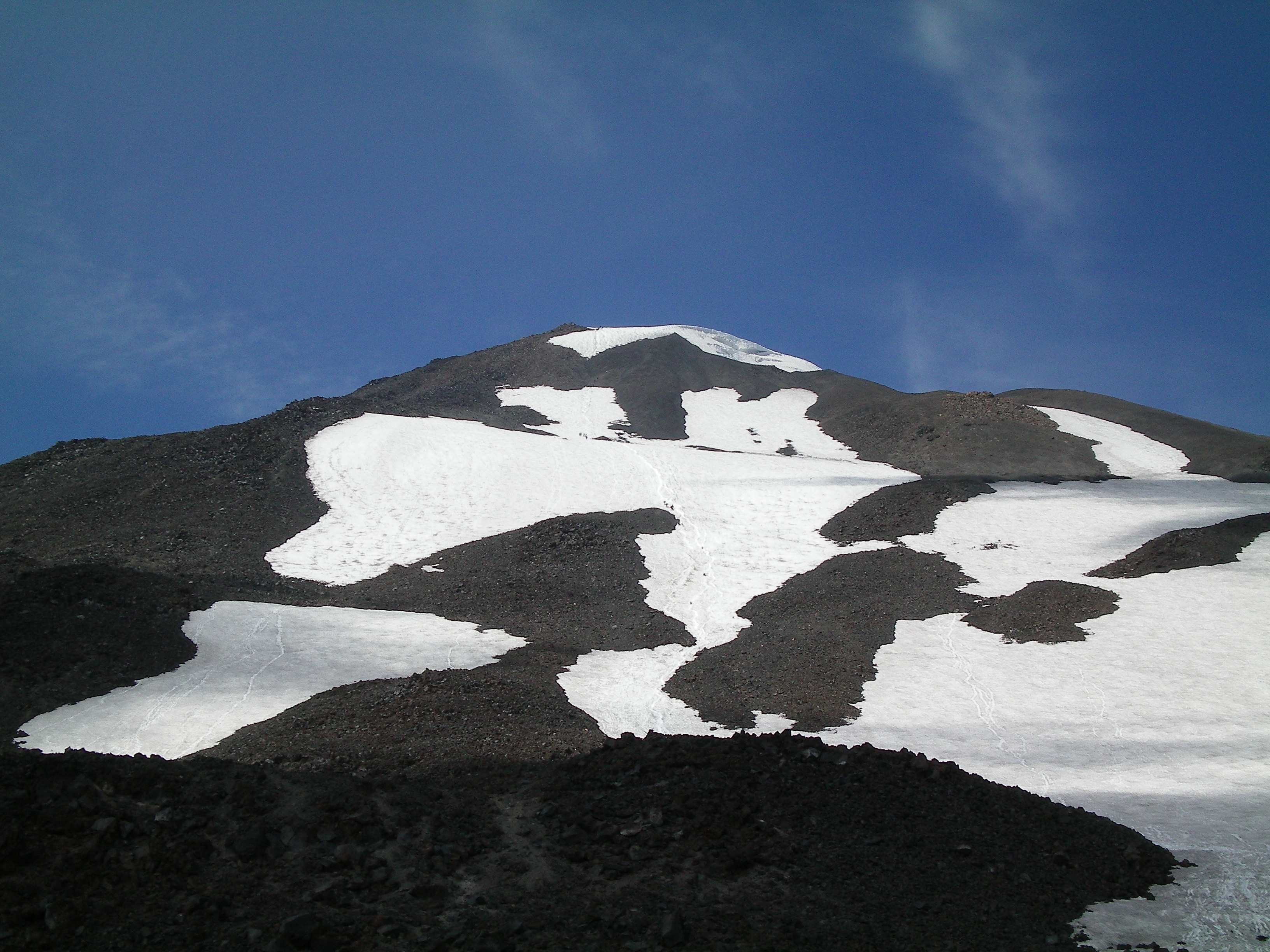
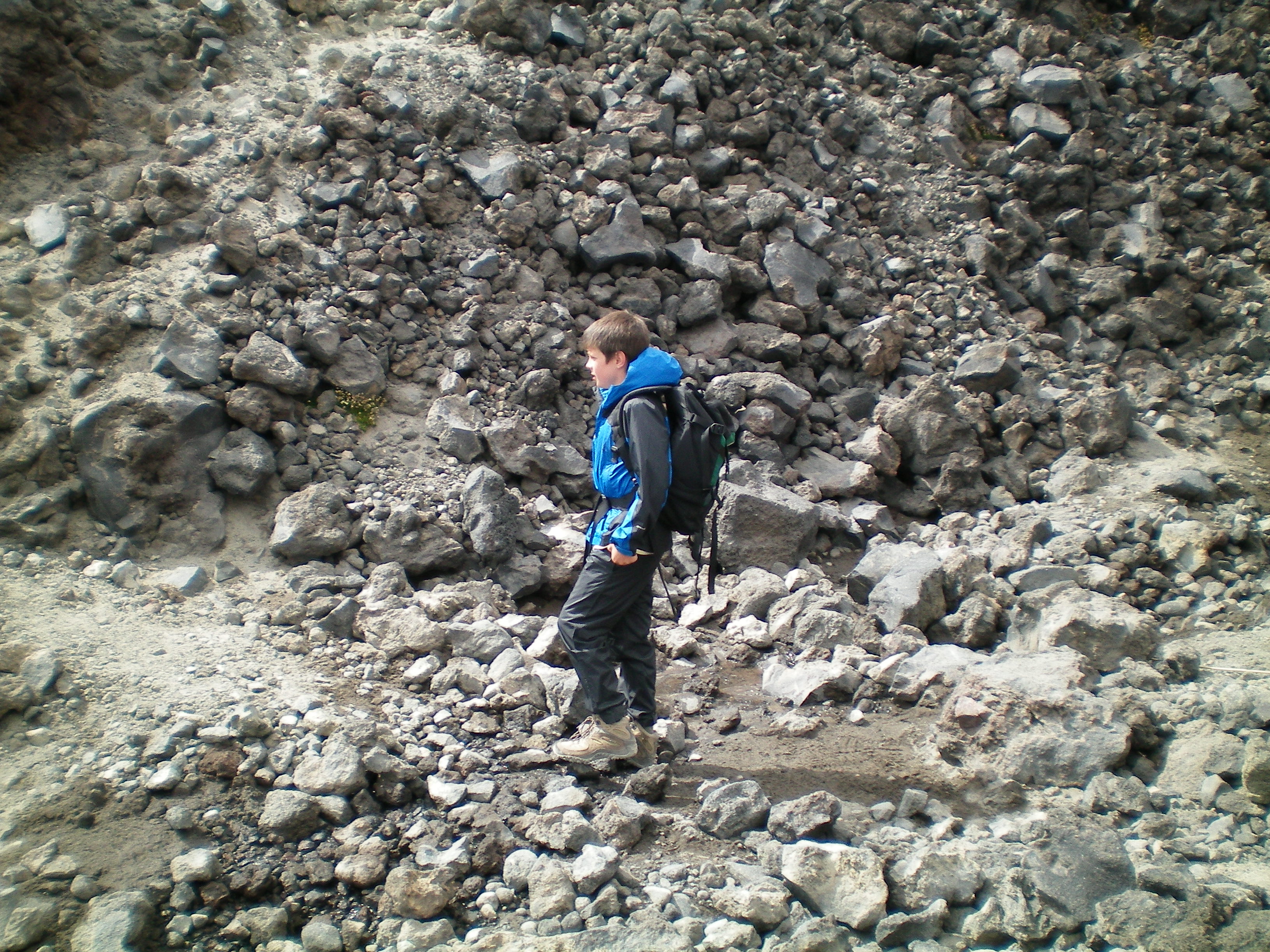
We started at about 9:00 AM, leaving our tent and sleeping bags and pads, taking breaks every hundred feet of altitude until the trail ended where it met the Crescent Glacier at 8000′. Liam got his first taste of hiking on snow/ice as we climbed the remaining 1400′ to The Lunch Counter, itself at the foot of an 1800′ pitch to the Pikers Peak false summit. We had lunch in the shade of a big rock. Then we climbed 200′ to the base of the really steep part, whereupon Liam realized that he’d left his sunglasses at our lunch site. He left his pack (my daypack) with me. Before he returned, the weather changed. I’d already seen a cap cloud form and grow on Mt. St. Helens, which I explained to Liam usually means that moister air was arriving, and sure enough before his return a series of amorphous grey clouds were playing peekaboo between us and Pikers Peak. We started climbing anyway.

We didn’t have crampons or ice axes. I’d climbed to at least the level of Piker’s Peak twice before without using them, and while I knew they were recommended, I hadn’t wanted to fool with them this time. But as we climbed past the 10,000′ level, the snow we were climbing, already steep, was getting icy. And the last thing I wanted to do on a slope as steep as this was to lose traction as the snow turned to ice. People coming down past us were reporting that conditions higher up had turned cold, windy, and icy. I told Liam we might have to turn back.

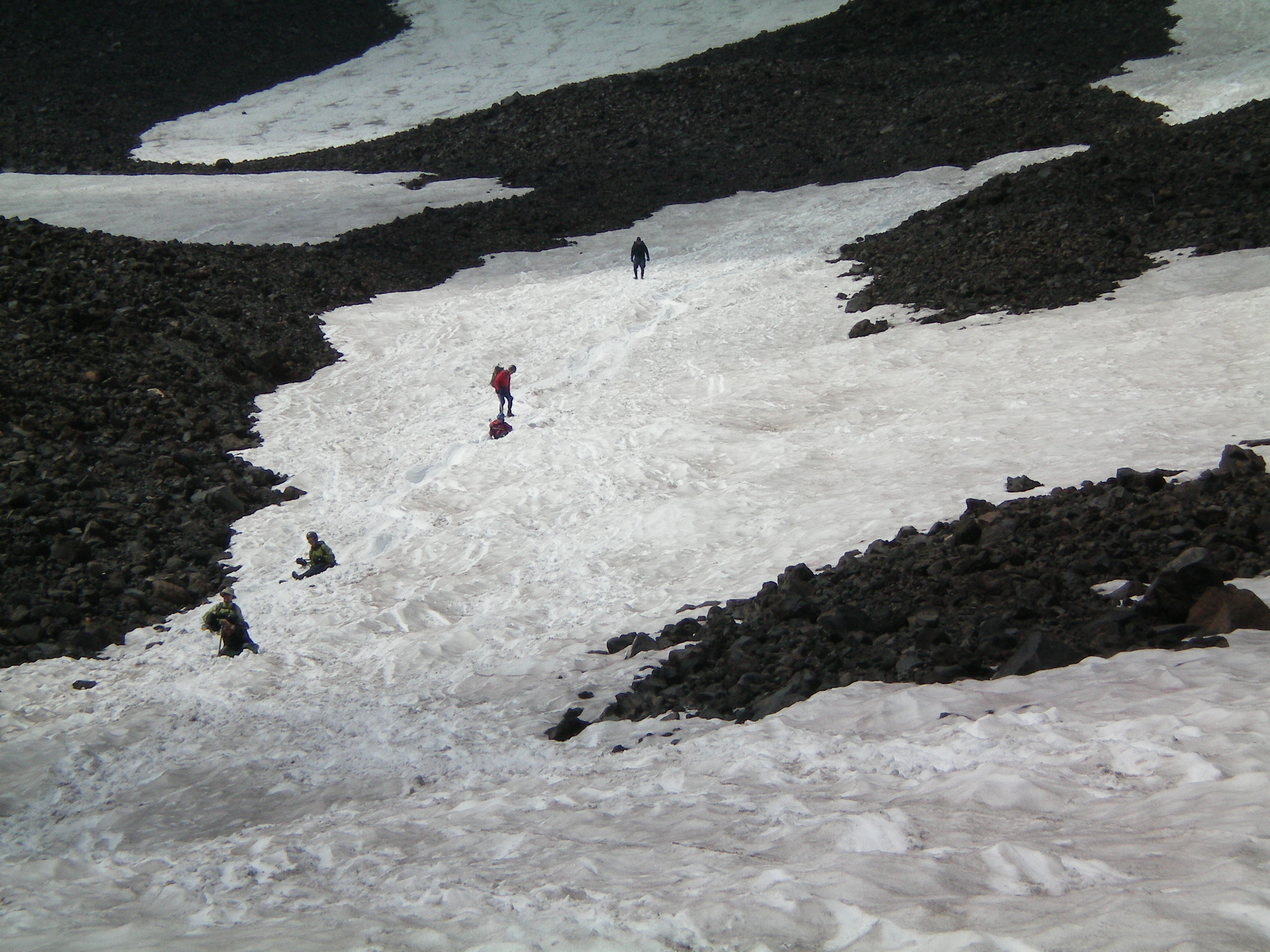
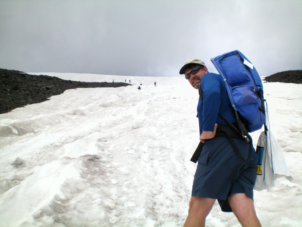
“Are you joking?!” he said, incredulous. A few sunbreaks followed. “See, it’s clearing up!” But the clouds returned each time. We’d climbed roughly 1/3 of the way to Piker’s Peak, reaching the top of a lobe of scree not far below what looked like a brief pause in the slope’s steep part. But each step at this level was one we had to cautiously chop into icy snow. I crossed the glissade trench to the top of the scree lobe and put on my long thermal pants, briefly mooning a few people as they glissaded past from higher up. Liam put on the waterproof pants I’d made sure to ask that he pack. It was cold, windy, and icy, and we were still far from the false summit. Liam got into the trench and started down. I did, too, but quickly realized that my external-frame pack wasn’t a good choice for action like this: its two vertical supports stuck down to the level of my butt while I slid down. They were useful as brakes, but as heavy as I was on an icy slope with slippery shorts over my thermal pants I was barely able to control my descent. Then the stitching on my 20-year-old pack gave way and the pack separated from its hip belt. I’d slid maybe 100′ down, mostly out of control, and now my butt and hands were numb and my pack was busted. Liam was out of sight below, but he’d been whooping and hollering at how much fun he was having before he got too distant to see. I walked the rest of the way down, chopping my heels into the snow before every step to make secure footholds. Going down was surer and a lot quicker than it had been going up. Liam awaited me at the bottom of the steep part.

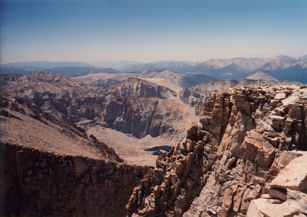
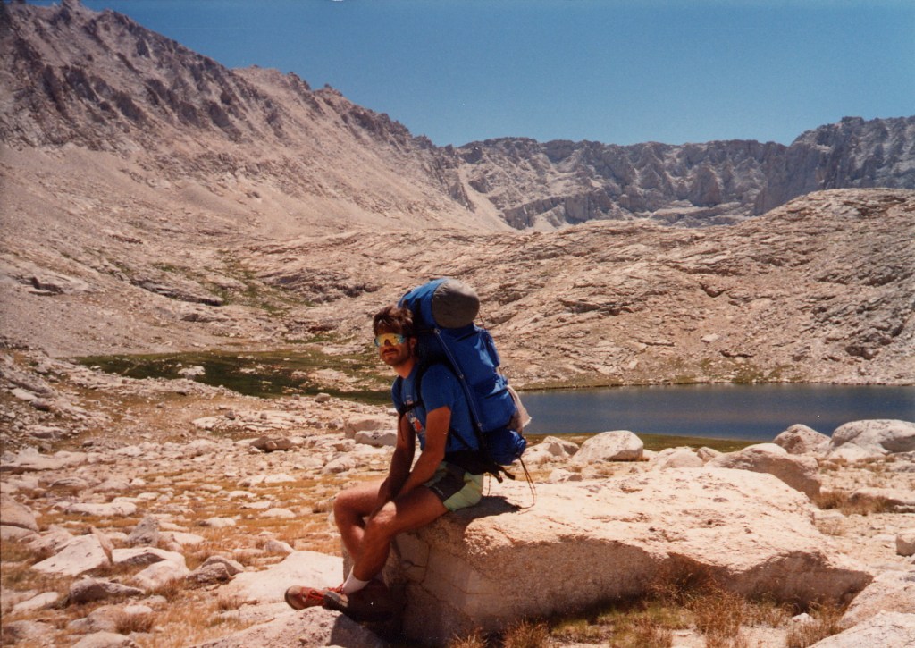
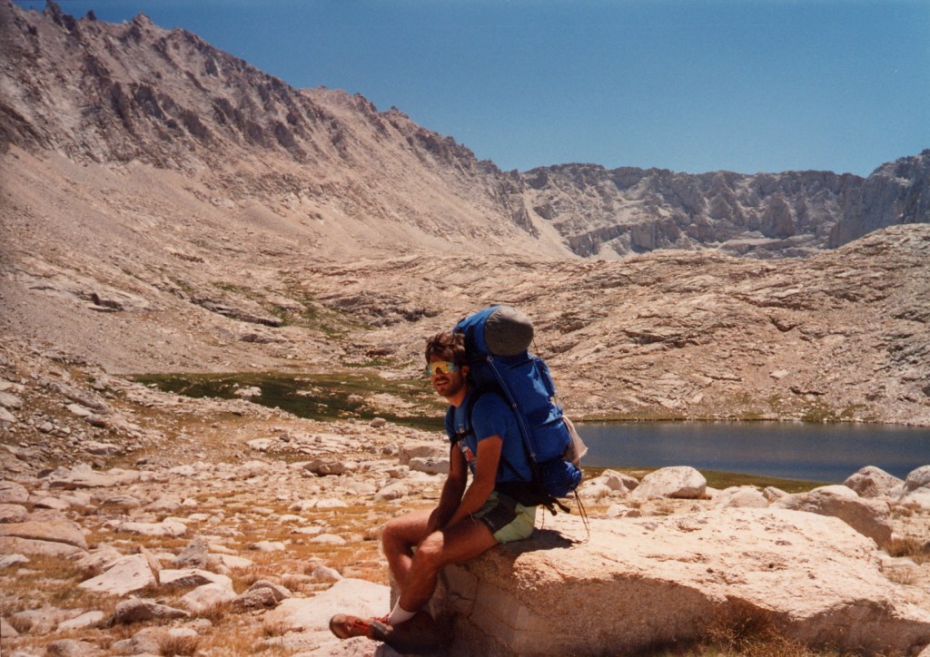
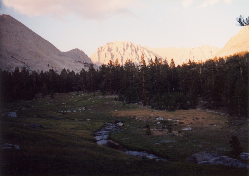
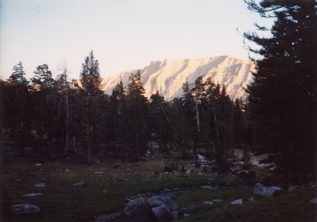
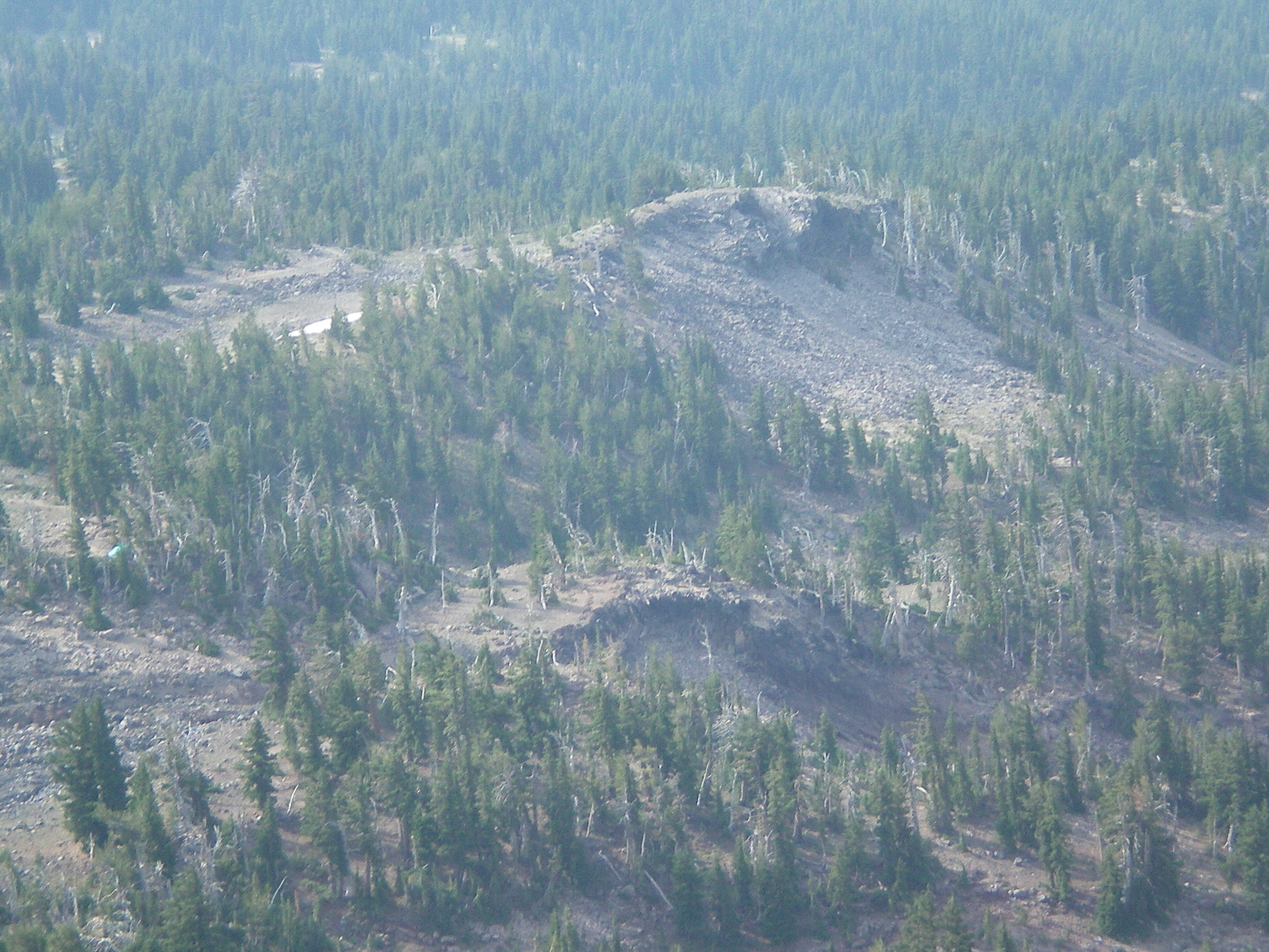
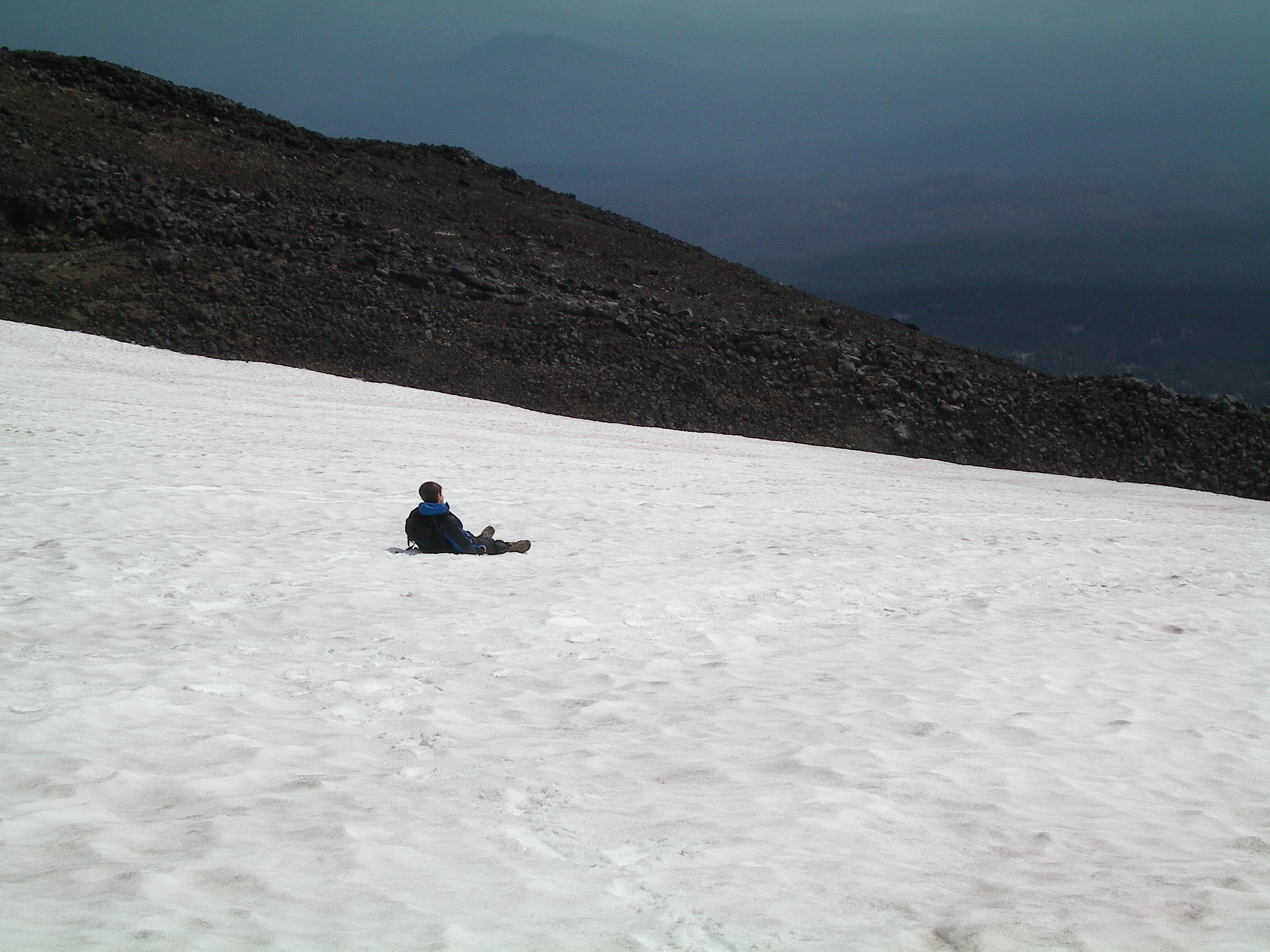
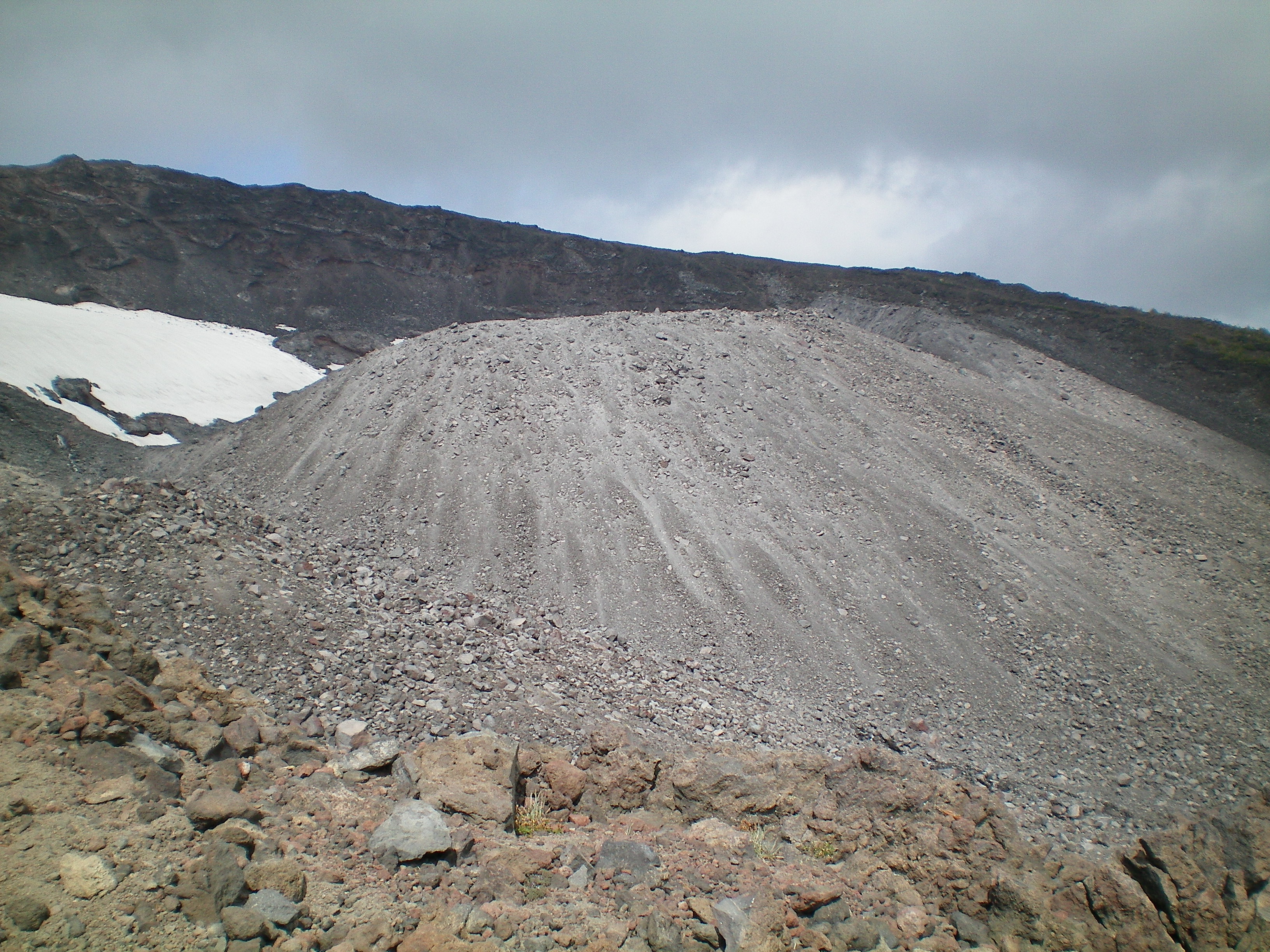
Behind us, the weather at the false summit had cleared. “Aw man!” Liam said. He told me he’d figured out how to brake by leaning back and letting his pack drag. Later he told me that glissading had been more fun than he’d ever had on any amusement park ride. I can see why: I don’t know of any amusement park rides that are 700′ high and where you control your own descent. We boot-skiied down the glacier back to 8000′, which was fun for both of us. Before long the summit clouded up again and Liam conceded that we’d made the right choice by descending. The rest of the descent to our campsite was uneventful, though I enjoyed showing Liam the Crescent Glacier’s terminal moraine, a huge pile of gravel partially intruding into the valley where we camped.

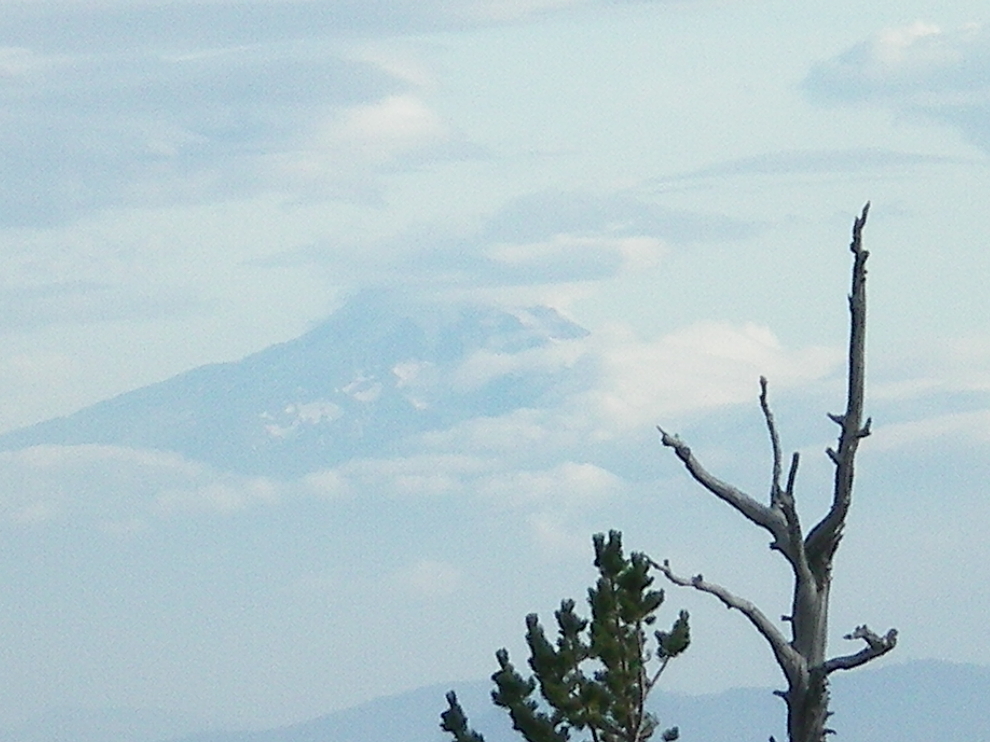
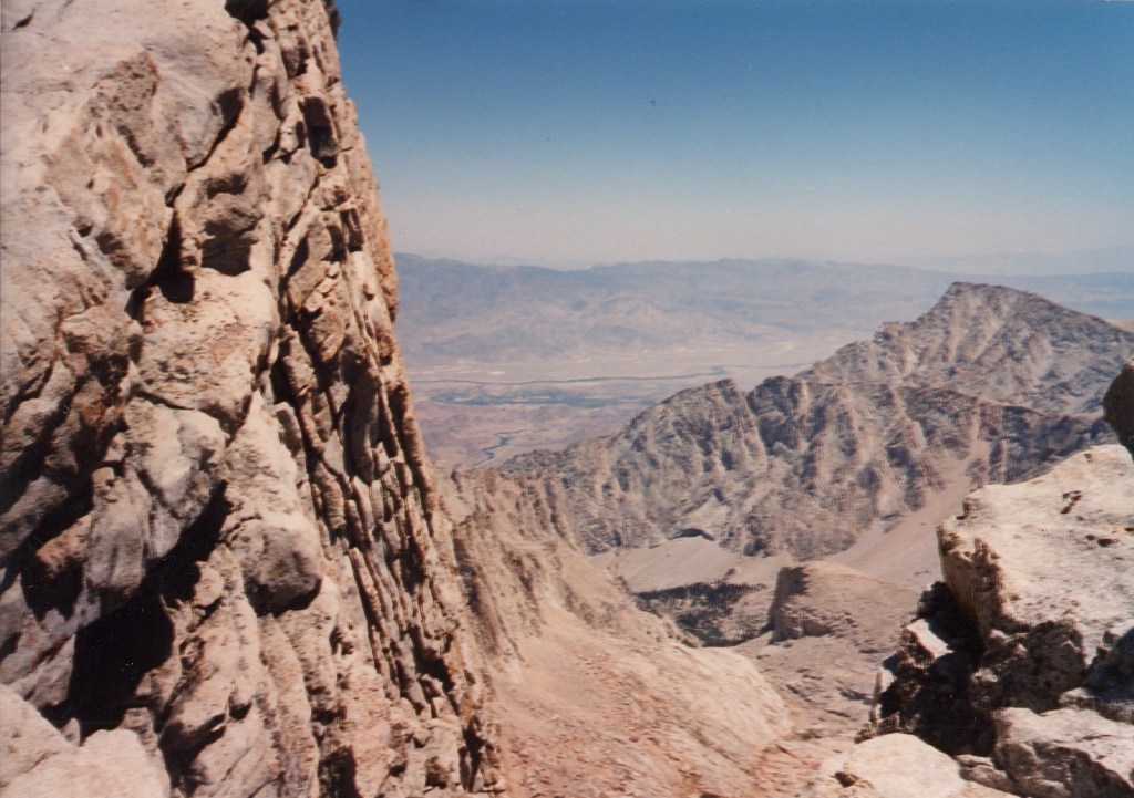
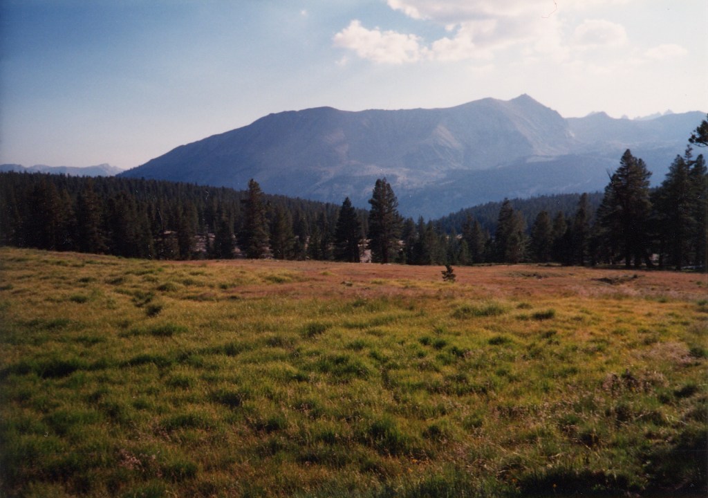
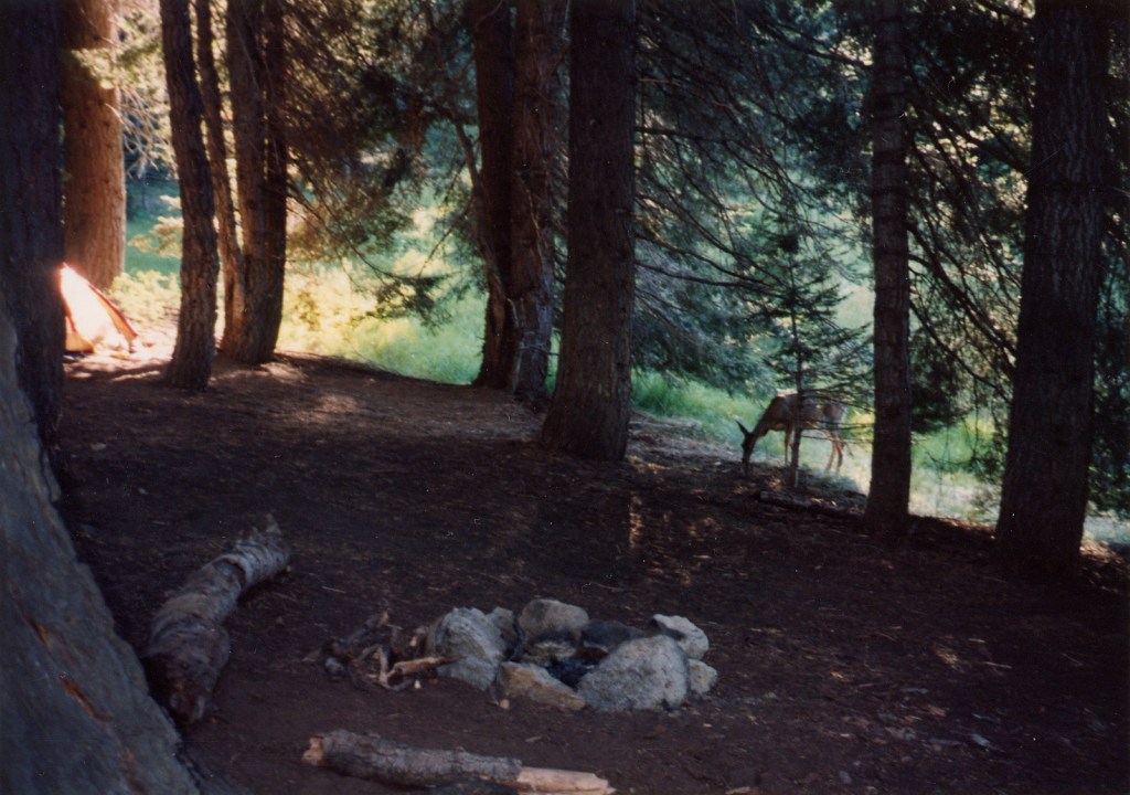
Back at the camp, the creek had dried up during the day, so we were going to be short on water. Liam lay down in his sleeping bag and said how nice it was to lie down. I did the same, and it was indeed, but Liam needed to go. We’d brought along a human waste bag from the Ranger Station, so I asked him to cross the creek and do his business there. I would clean up after both of us. I woke 15 minutes later when Liam said he was done. I headed over and tried to do mine. I heard a clatter of stones and looked across the ravine to see a marmot crossing a field of slate to sit on a big overlooking rock. We looked at each other for some time. Eventually I zipped up and packed our leavings into the provided bags. A couple had made their way into a campsite maybe 30 yards away from our latrine site and were engaged in quiet conversation, unaware of both me and the marmot. I’d heard them from farther away but didn’t know they’d come closer. I smiled and waved, letting them know about the marmot. They barely acknowledged me. I called out to Liam to bring his camera and our binocs, then we watched the marmot and enjoyed the view; we looked south towards the Columbia River gorge and across to Mt Hood, with several lines of not-insignificant ridges between, a light haze in between making for a beautiful vista.

Back at the campsite, I boiled two cups of water and we had ramen. Liam was blown away by how good it tasted, and asked that we have ramen the next morning rather than instant oatmeal, even a more palatable flavor than “original”. I asked if Liam wanted to hike out today, as there wasn’t much left to do until the stars came out, but he said he wanted to stay another night because he didn’t want our trip to end, which warmed my heart. We only had 2 1/2 cups of water left, but that was easily rectified in the morning.

High Sierra Trail with Dad, day 8

Sunday morning, August 1990; Trail Junction – Whitney Summit – Whitney Portal

Our lack of water makes me think giving Peter half a liter was a bad idea, but I have no regrets. We have less than 1 1/2 liters and will probably be down to just more than 1 by departure time. This morning it looks like we’ll be rolling by 9:30. Dad says he feels weak. Hopefully he’ll improve once we start. The valley below us looks sandblasted – white rock infrequently laced with tan dirt, rare green vegetation, and of course, the lakes. There is so much white that even the forests beyond look thin. What a moonscape!

Guitar Lake

The slope we camped on is strewn with flat boulders jumbled every which way. We can see tiny patches of snow, widely separated. Already something like 25 people have gone up from the trail junction to Whitney summit, though none from the same direction we came up from. They seem shallow, these day-hikers or overnighters, and many of them carry what look like ski poles. For balance? They seem trendy. I like hardcore backpackers more. Dad and I both definitely smell now, and there is no water for toothbrushes. I think we’ll be down by 6 PM. Dad and I both noticed more hair loss than usual last night.

Sunday night

The last 1000′ to Whitney summit was tough. It took 2 hours and a lot of heavy breathing. We had slightly more than 1 liter of water and took most of it up along with Dad’s little green bag. We left our packs at the trail junction. There were about 20 festive people at the summit, lots of picture taking, and much oohing and aahing over the cabin shelter there, which had been struck by lightning within the last two weeks, killing at least one person who’d taken shelter inside.

The panoramic view was a real spectacle, especially to the north and east, which dropped about 2000′ straight down. The Guitar Lake valley seemed tiny, the jagged Kaweah ridge dominated the view to the west, and we could see a lot of unexpected snow and water to the east, with the town of Lone Pine sitting far below and a good distance beyond. The summit was a nearly level jumble of the same kind of solid, flat boulders we’d seen at our campsite last night, gradually sloping up to the precipitous east face where all the people were clustered. On the trail register under “Suggestions” I wrote that the rocks should be rearranged to make the mountain higher. Several geodetic survey markers were on the summit, as well as a plaque put up in 1930 telling us that Mt. Whitney was 14,496.81′ high. People gravitated towards the highest mark to briefly be the tallest person in the lower 48, myself included.

Standing on the USGS marker at Whitney Summit

On the way down I noticed the rough trail more – it wasn’t at all the superhighway of a trail Dad said he’d expected. Halfway down to the trail junction we met someone who said there were people keeping the marmots away from the packs left there, and since ours had been the only ones there when we’d left them, I ran ahead to see. When I got there I found our packs in good shape and five people in various stages of indecision about where they wanted to go after climbing Whitney, all of them backpackers. We’d already met one of them at the summit, where he’d been lamenting that he’d forgotten to take any film on his just-completed first summit trip. None of the backpackers had more than 1/2 liter of water and the consensus was that they could bum some from day-hikers. On the first attempt any of them made at this, the only one I saw, they were successful. One of the backpackers was an Englishman who commented that marmots were nothing like their equivalent in the Alps – neither cute nor particularly friendly. Ground squirrels, however, he affectionately called “cheeky little bastards”. Aside from a few ground squirrels and marmots, plus a group of six ubiquitous crows and several acquisitive little brown birds with purplish-magenta underfeathers, I saw no other non-insect wildlife anywhere near the summit.

When Dad rejoined me we grumblingly put our packs back on and climbed the 300′ back up to Trail Crest – which took a lot out of Dad – then started the long switch-backed descent towards Trail Camp, Outpost Camp, and eventually Whitney Portal. We’d been warned by the Crabtree Meadow ranger that no water on the east side of Whitney could be trusted to be free of Giardia bacteria, so we hoped at each landmark to find the faucets we hadn’t seen since our first night at Bearpaw Meadow. We found none, of course.

At about 11,500’, I stopped to get a liter of water from the stream flowing beside the trail, boiled it twice as long as usual, then cooled it and drank half immediately, leaving the rest to Dad. When we reached Outpost Camp at 10,900′ he suggested that I hurry down to let Mom know we were OK as early as possible, so I motored and was down 1:10 later, at 6:40. On the last section, I picked up quite a train of people, seven or so, who fell in line behind me as I went and kept up, by and large. It was very strange.

Uncle Paul and his young son Pauly greeted me at the bottom – Mom hadn’t come. They had cold drinks and BEER and ham sandwiches and brownies and different shoes for us, and I ate and drank food and drink I hadn’t tasted in a very long time and was immensely happy. Paul said I looked ready for another week in the mountains when I first got down, but after that first beer I got very sleepy and heard no more such comments. Unfortunately, Paul hadn’t brought towels or Band-Aids, though the generous proprietor of the small store at the head of the parking lot gave me two much appreciated Band-Aids. I was too afraid of getting athlete’s foot to want to use their showers, though I needed one badly.

We took some more pictures when Dad arrived, then we cleaned up as best we could and began the drive down to Lone Pine to drop off our wilderness permit at the ranger station there. We stopped the car on the way down, after the sun had set, to admire the silhouette of the elusive Whitney summit. You can only see it if you are directly to its east or west, except for a few narrow windows between lesser surrounding peaks. The summit looked very small from here, though the arc of the highest few hundred feet seemed to strain upwards like a living thing. The moon shone pale violet again in the darkening sky.

High Sierra Trail with Dad, day 7

Crabtree Meadow – Trail Junction

We are up before 8 AM on Day 7 and are nearly able to break camp very early – it looks like we’ll be out by 9:30, but I take a long time boiling more water in the morning and Dad takes a long time washing his feet. We are ready to go by 10:15 but the ranger shows up then and chats with us. I get to talk in a very shallow way about neurotransmitters with him – he is doubtless as pleased as I am to show how much neat stuff he knows, and he also tells me that the Forest Service is having difficulty finding front-country rangers. They drive around in cars and act like rent-a-cops and get paid squat, but evidently you must put in your front-country time if you want to be a back-country ranger. I like the man a lot, which is very pleasant considering the evil private-toilet-related thoughts I’d had the previous evening. We are on the trail by 10:45.

Dad is not strong today and we struggle up the 800′ to Guitar Lake where we have lunch and Dad gets a nosebleed. I worry that we will not make Trail Crest by nightfall.

We climb together to the next little lake at 11,600′, watching a couple of kids recede upwards, and I offer a repeat of Day 2, when I’d climbed to where we wanted to go, then gone back and brought Dad’s pack up, too. I have lots of fun charging uphill and leaving the two kids in my dust. The charge is also nice because I haven’t really had much of a chance to challenge myself against the mountains. My shirt gets pretty wet from sweat, and I reach the trail junction at 13,400′ 1 1/2 hours later.

I meet Peter at the trail junction and give him half a liter of our water, as he is nearly out. Then I charge downhill to meet Dad, who has come 2/3 of the way up by this time. We camp 100’ below the trail junction, on a slope overlooking Guitar Lake and the Hitchcock Lakes, with a monster vertically-seamed bluff as a backdrop. Because even Guitar Lake is above the treeline, judging distance below is difficult and the valley seems smaller than it is. Dad is in bed by 7PM and I stay up to write this. About the time I finish writing up Day 6, the sun goes gently down behind some 13,000+’ peak or other – perhaps slightly higher than we are – on the other side of the Kern river in a red, smoggy-looking sky Dad brought to my attention some time ago, suggesting that it was red because of a fire. We find out later that he is right. The red in the sky goes up higher than we are, and it is hazier to the north. The lakes far below are green, barely rippling jewels until the light fades, though a part of one not in the shadow of the bluffs still throws the post-sunset sky’s violet glow back at me. The sky straight above us today is a deeper blue than usual – the air is so thin up here that the black of outer space is not so obscured. The quarter moon to the southwest is also violet and I wonder how many stars I would see if I stayed up tonight. It is so cold now that I think I won’t find out.

I measured our progress today by comparing my height with the heights of peaks or shoulders in the valley. 12,700′, 13,100′, each fell below me, revealing even taller peaks beyond. I can see for a long way now, though not so well as two hours ago when the haze was less. A first star has appeared overhead, yellow-red and unwinking, but my legs are beginning to shiver and I think it’s time to go in. A glider flew over Whitney today! I have forgotten what my science fiction dream was about.

High Sierra Trail with Dad, day 6

Junction Meadow – Crabtree Meadow

On day 6 we return to hard climbing – from 8000′ to 10,700′ in less than nine miles. We try for an early start and manage 10:45, which is still 90 minutes after Peter leaves. The previous two easy days are a help and we make great time for 1200′ until stopping to take our packs off and have a snack.

After that it is harder to get going, and the altitude takes an increasing toll. We stop for lunch at the John Muir trail junction at 10,200’, where for the second straight day I slip and go ankle-deep into a stream. I make the best of it by going full into the stream later – God is it cold – but it is still strangely tolerable. I’m not sure why this is: except for some shivers Dad gets in the evening, we seem to be more tolerant of temperature extremes, but five minutes in is plenty. The spot I choose for my swim is right near the trail and a hiking couple surprises me – and me them – just after I get full in. They say it looks great and I say it looks better than it feels. Unfortunately, no soap in the streams is allowed, but I feel a lot better even if I am not much cleaner. I’ve noticed by this time that I’m smelling quite ripe, and quick dunks in the cold water don’t help much.

Lunch buys Dad some new energy, but it fades before we climb the 500 – 600′ still left to go. The trail gets as high as a wide, sandy plain at 10,900′ before descending to Crabtree Meadow.

Crabtree gives us our first look at Mt. Whitney, the highest peak in the lower 48 states, and we arrive about 7PM, enough time to get a picture of the low orange-gold rays shining on it. The view of Whitney and some surrounding peaks and bluffs is spectacular. I dash ahead for the last mile into camp looking for a toilet and find one but it is not for public use. I think dark ranger thoughts, dig a hole, and do my stuff in the meadow behind a big log. I’m back at the campsite just before Dad arrives. The toilet incident makes me grouchy enough that Dad must think once or twice about what an asshole he raised, but he doesn’t show it if he does. I see Peter briefly, but we camp far enough from each other that we do not see each other again that night. I learn from him that there is no public toilet, and also that there are none of those near-mythical faucets I’d been hoping to find since morning. We know we have to get an early start on Day 7, so we boil extra water overnight – not enough but still a goodly amount. I suspect that there may be no more water to be had by the trail, and hope to go out with a full load for the first time since Day 1. Or was it day 2?

That night I have a dream about two college friends that disturbs me, keeping me awake thinking about it long afterwards. I decide in the wee hours that a couple of changes to it would make it a decent science fiction short story, and by the time the sky begins to lighten, I am fast asleep again. This is the usual pattern for both Dad and me, we sleep like rocks for several hours, fidget in the wee hours, and finally sleep like rocks again about the time the sun comes up.

High Sierra Trail with Dad, day 5

Kern River Canyon

Day 5 starts very late – 1:15 – but since we know it’s to be another easy day, this is not a concern. Our view has by now been limited by the high canyon walls to just a few miles ahead and behind, except where an occasional notch in the wall to the east or west allows us a window to the highest peaks beyond. We go 8 miles up the river, gaining about 1000′ to the Junction Meadow campsite. Along the way I begin to admit to myself that the canyon’s comparison to Yosemite Valley is valid in its way. The canyon walls are very steep, rougher than the sheer Yosemite cliffs, but with very little space for trees to grow from, barring the occasional cliff shelf. It is very impressive and quite beautiful. I think later that it is also so deep that it has hidden the very rugged country on either side of us quite effectively for more than a full day.

We meet Peter at Junction Meadow and he feeds us some of his extra food that night, mostly carrots and cabbage and not very tasty. We share some pasta shells and apple cobbler with him in return. He is out of fuel for his stove and boils his water on a campfire, and we pick up the trick from him, being low on fuel ourselves. Dad likes the campsite a lot, I think because it is the closest one yet to water. Though he has intelligently brought moccasins for walking in after we’ve made camp, he isn’t fond of walking once we’ve done so, and fetching water to be boiled for drinking is a necessity at least twice a day.

Day 5 was our first day using Second Skins rather than Band-Aids, and they are a huge help. After putting them on in the morning, I almost forget my toe is blistered, and Dad says the same thing when I ask. By this time he is taking better care of his feet and the difference is marked.

High Sierra Trail with Dad, day 4

Saturday night, August 1990; Chagoopa Plateau – Kern River Canyon

Luckily, despite our amateur job in stringing up our food, we heard no bears overnight. We are now a long way from help, and losing our food would be costly. The fourth day began as clear and blue as each of the previous ones. We have now passed the easternmost of the Kaweah Peaks and the trail has moved away from Big Arroyo, northeast onto the fertile Chagoopa Plateau. In another two miles we passed Sky Parlor Meadow, the campsite we’d been hoping to reach the night before, but this day was supposed to be an easy one and the extra distance would be easy to make up.

In another mile the downhill began to steepen. The trail dropped nearly 2000′ to the Kern River, easily the largest river we expected to encounter on this trip. Along the way, we reached a rather small meadow that reminds me more of Lombard Street in San Francisco than anything else. The meadow is drenched in sun, with summer flowers growing everywhere.

The nearly white trail steepens again, threading neat, symmetrical switchbacks through the meadow.

Shortly afterward the trail reaches Funston Creek and parallels it as it cascades into the valley below. I have heard Kern Canyon compared in impressiveness to Yosemite Valley itself – high praise indeed – but when we finally catch sight of its southern reaches it is not so dramatic as I’d hoped. It is deeply glaciated but not so sheer as Yosemite, and trees grow more or less continuously on the valley walls.

Incredibly, the trail steepens again on its final drop into the Kern Canyon. Two men with mules pass us on their way up. We come around a bend and catch our first glimpse of the northern section of the valley, and it is a good deal more impressive than the more southerly section we’d seen earlier, though still lacking the visual impact of Yosemite. Our view of this southern section is now blocked by the bend we’ve just come around, however, so we can’t make a direct comparison.

At the bottom is a large, sandy campsite, with a shaved-log gate across the trail dividing the area set aside for parties with horses from the rest. We search for faucets like those we’d seen at our first camp in vain. Some amenities are apparently not available more than one day’s trip into the backcountry. By now I am glad the park is named Sequoia and not Really-Beautiful-Mountains National Park: though we haven’t seen any sequoias since the first ten minutes of our hike, I think the park’s name has probably discouraged many more people from coming this deep into it, and I like it better that way. The elevation at the bottom is about the same as where we started hiking on the first day, and I am vaguely unhappy that we’ve worked so hard for all that altitude and had to give it all up again.

The Kern River is indeed the largest flowing water we’ve seen yet, but I still hesitate to think of it as a river. It looks at most to be a large creek, though such things are relative in California. I imagine at peak snowmelt in the spring it is somewhat friskier.

We crossed the river on a sturdy, welcoming bridge, no more than 50 paces long, on which I persuade Dad to have his picture taken.

On the other side the trail goes up a little way to Kern Hot Springs, where our map does not show a campsite but where the name leads me to hope that we will find one. We arrive in the late afternoon, having traveled a total distance of only 7 miles today, and easy going at that. I think we’ve needed the day off. A campground is indeed a few hundred feet beyond the spring.

The spring turns out to be no big deal – it is a small metal tub with room for only one person set into the hillside less than 100’ from the river. The tub has a fine view, as no trees stand close to it, but the water in it is neither hot nor particularly deep. I learn later, to my chagrin, that we didn’t know how to work it correctly – it would have been both hotter and deeper if we had pulled the wooden plug from the spring’s source and put it into the drain. I take a dip in the very cold river, then displace Dad for my turn in the spring. Despite our ignorance of how to properly operate it, it is still nice enough that I don’t want to get out.

We have company for the first time in the evening – a German named Klaus Peter or just Peter. We talk with him briefly and discover that his plans are similar to ours, so we expect to see him again further down the trail. Later that night, in the dark, I drag Dad down to the river and cut away at his ugly blister. By this time I have one of my own, though it isn’t in such bad shape. We clean them out, howling at the green soap and alcohol disinfectant pads, but we both feel better for it.

High Sierra Trail with Dad, day 3

Precipice Lake – Chagoopa Plateau

In the morning we discovered that bears were not the only animals to be heeded in the mountains, though they might be the only ones to be feared. Dad had left his sweaty, salt-encrusted shirt hanging to dry on his pack overnight, and marmots had gotten to it and found it tasty, chewing many small holes around the collar and down the shirt front.

The day started with the mid-morning sun lighting the rocks tan and dusty grey instead of the spectacular colors of the previous evening.

Precipice Lake was within 300 vertical feet of the first mountain pass we would cross, Kaweah Gap. The trail led us through a small, fragile basin that looked like Arctic tundra, though it was surprisingly lush for a landscape without trees. We stopped at the top to admire the view, take a few pictures, and feel good about ourselves for climbing to the highest point we would reach during the first week of our hike.

Over the top was the Nine Lakes Basin, which drained into a larger, gently glaciated and southeast-trending valley named Big Arroyo, which was bounded to the east by the same Kaweah Peaks we’d seen since our first day of hiking.

The trail led far down the valley and we welcomed the long downhill respite, then had to unexpectedly regain nearly 1000′ we’d lost from the Gap. I wouldn’t realize my map-reading error until hours later.

Dad grouched, but then I was sure the top was just around every bend and kept telling him it was, so he had reason to be sore.

We finally reached the high point of that section of trail in the afternoon, then took a protracted bathroom break at 5 PM, breaking out the plastic trowel I’d bought especially for the purpose. I wrapped it carefully in a big plastic bag and rolled it up tightly before putting it back into my pack.

Afterwards we made excellent time for another 2 or 3 easy downhill miles, racing to reach a campsite by dark, but when we still hadn’t reached one by sunset, we stopped at the first likely-looking spot we could find. We spent something like an hour suspending our food in a sleeping bag’s stuff-sack between two trees for the first time, and even got snappy with each other as we debated how best to do it so that it would be out of reach of any bears who might happen along. The job we did was less than perfect. Later, my stove flared and flash-fried most of the hair on my wrist, and a blister on Dad’s feet seemed as though it was getting infected. I dreamed I went out on a self-conscious date with the midget hooker from “Total Recall.” Kris Kristofferson was somehow involved.

I am enjoying my dreams. Was this what Plains Indians went through when it was time to choose a totem animal?

High Sierra Trail with Dad, day 2

Wednesday morning, August 1990; Bearpaw Meadow – Precipice Lake

We heard loud bark-cracking noises overnight, and Dad was up early enough to see a shy, cinnamon-colored bear cub high up in a tree. It was gone before I got up. Later in the morning, a deer came to within 20′ of the tent. It let Dad get pretty near before running off, though it didn’t run far and stayed fairly close for a while.

To our surprise, we found a faucet like any you’d find in a suburban garden at the back of our campsite and filled our canteens from it, wondering if this was the last of any such amenities we could expect for a while. Just on the other side of the campground we came upon a ranger station and about 15 beatifically smiling people, mostly women, eating and admiring their view of the Kaweah River Valley from inside their long lodge perched high on the valley wall. It was as much open space as we’d yet seen on our hike. We learned that the lodge, which the park calls a camp, is available to anyone who wants to have a longer-term access to the backcountry without having to worry about packing in their own food, water, or tent. I felt something like a peasant, albeit an adventurous one.

Day 2 was supposed to be our first difficult day and it proved to be grueling. We walked up towards the head of the Kaweah River Valley with the Hamilton Lakes and a difficult climb beyond, stopping to lunch and laze at a waterfall not far from the head of the valley, then passing three atttractive women returning to the camp we’d left behind in the morning. A few hundred feet higher was the Hamilton Lakes basin, shaped like an irregular bottle and surrounded on all sides but the bottle’s lid by sheer ramparts 2000’ higher than the basin. The lake itself was large and very pretty, but we learned as we passed the campsite there that a bear had come through the previous evening to devastate the packs and supplies of a family who hadn’t stowed them properly. We took the warning to heart.

The climb on the far side of the lake was as difficult as the map had made it seem. I had to carry Dad’s pack for the last half – which involved lots of shuttling back and forth, carrying one pack up a few hundred feet, then running back down to pick up the other and relieve Dad of it for a little while. We passed a small, unnamed lake and camped at the starkly marvelous Precipice Lake just before sunset, on a bare patch of gravel not quite fine enough to be called soil. The air got cooler very quickly and we both had to put on extra clothing.

The lake itself was small and cold and calm, the weathered land around it seemingly made up of only five colors: a charcoal and a lighter shade of grey for the rocks in shade, an occasional patch of green where the mountain grasses could find a little eroded rock to root in, the surprising white of several patches of snow that had managed to survive the summer, and a brilliant orange-gold where the setting sun still shone on higher rocks. We left our food in our packs despite the warning we’d received earlier in the day, as the last trees we’d seen were 2000’ below us and I figured we were far above bear country. I dreamed of a woman I liked.

High Sierra Trail with Dad, day 1

Monday morning, August 1990; Crescent Meadow – Bearpaw Meadow

Much of the first day’s hike was a gentle uphill, 11.3 miles from Crescent Meadow in the Giant Forest of Sequoia National Park to Bearpaw Meadow, which is just back from a steep 1400’ drop to the floor of the Kaweah River Valley. We spent little time in the Giant Forest itself, saying goodbye to my Uncle Paul, who’d driven us from Sacramento the night before to drop us here, leaving the big sequoias for which the park is named behind almost immediately. I spent the day getting used to the feel of my pack, adjusting it tighter as the day wore on to shift the weight more from shoulders to hips, where it belonged, despite the initial discomfort of the tight fit around my waist.

We carried about 100 pounds between us, and I looked forward to eating the packs lighter. Our Pop-Tarts were first to go, before they had much of a chance to crumble, as they inevitably do after more than one day in a backpack. The weather was clear, the Kaweah peaks in the background getting closer as we wound our way toward them. We passed several lower-altitude domes on the other side of our broad valley as we gained nearly 1000’ of altitude, seeing them from all angles as we went.

The difference in perspective was fascinating, and I marveled at how different they could look from behind, when they sometimes seemed so simple in structure from the front. When the ground was flatter, the trail was firmly packed soil through sun-dappled forest. Where the slope of the valley wall was steeper, the trail was forced around and over massive, grey-tan, rough-edged granite boulders full in the bright sun. The trail builders had even cut rough steps through the granite where there was no way around it.

At the end of the day, the trail lost 400’ and gained 600’ back within less than a mile, our first sore test of climbs to come. Dad had trouble with the final stretch to the campsite and accepted my help in taking his pack for the last quarter mile. This was supposed to be an easy day.

For dinner we made the last of our relatively fresh food. I’d brought olive oil, basil, parmesan, and tortellini, and once we’d picked some sunflower seeds out of our gorp to stand in for pine nuts and mixed it all together in the dark, we made pesto, calling it sunflower seed and mosquito pesto for the large number of mosquitos now flying all around us and presumably into our food.